Windmühlen-Berg
Windmühlen-Berg is a hill in Haldensleben, Börde Rural District, Saxony-Anhalt and has an elevation of 72 metres. Windmühlen-Berg is situated nearby to the village Uthmöden, as well as near Satuelle.| Tap on a place to explore it |
- Type: Hill with an elevation of 72 metres
- Description: hill in Saxony-Anhalt, Germany - Geonames ID=2808123
- Also known as: “Windmuhlenberg”
Places of Interest
Highlights include Schloss Dorst and Detzel Castle.
Schloss Dorst
Castle

Photo: Nuxvonhier, CC0.
Schloss Dorst is a castle, which is situated 2½ km north of Windmühlen-Berg.
Detzel Castle
Building
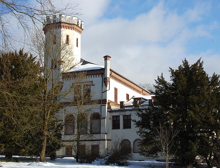
Photo: Olaf2, CC BY-SA 3.0.
Detzel Castle is a building, which is situated 3½ km south of Windmühlen-Berg.
Places in the Area
Nearby places include Haldensleben and Roxförde.
Haldensleben
Town

Photo: Clemensfranz, CC BY-SA 3.0.
Haldensleben is a town in Saxony-Anhalt, Germany. It is the administrative seat of the Börde district. Haldensleben is situated 7 km south of Windmühlen-Berg.
Roxförde
Village
Roxförde is a village and a former municipality in the district Altmarkkreis Salzwedel, in Saxony-Anhalt, Germany. Since 1 January 2010, it is part of the town Gardelegen. Roxförde is situated 9 km north of Windmühlen-Berg.
Windmühlen-Berg
- Category: landform
- Location: Haldensleben, Börde Rural District, Saxony-Anhalt, Germany, Central Europe, Europe
- View on OpenStreetMap
This page is based on GeoNames, Wikidata, and Wikimedia Commons.
We’d love your help improving our open data sources. Thank you for contributing.
Satellite Map
Discover Windmühlen-Berg from above in high-definition satellite imagery.
In Other Languages
From Cebuano to German—“Windmühlen-Berg” goes by many names.
- Cebuano: “Windmühlen-Berg”
- Dutch: “Windmühlen-Berg”
- German: “Windmühlen-Berg”
- German: “Windmühlenberg”
Places with the Same Name
Discover other places named “Windmühlen-Berg”.
Localities in the Area
Explore places such as Uthmöden and Satuelle.
Notable Places Nearby
Highlights include Triepelberg and Linderer.
Saxony-Anhalt: Must-Visit Destinations
Delve into Magdeburg, Halle, Wittenberg, and Quedlinburg.
Curious Places to Discover
Uncover intriguing places from every corner of the globe.
About Mapcarta. Text is available under the CC BY-SA 4.0 license, except for photos, directions, and the map. Photo: GMM, Public domain.