Hohberg
Hohberg is a peak in Radeburg, Meissen, Saxony and has an elevation of 175 metres. Hohberg is situated nearby to the village Bärwalde, as well as near the locality Die Folgen.| Tap on a place to explore it |
Places of Interest
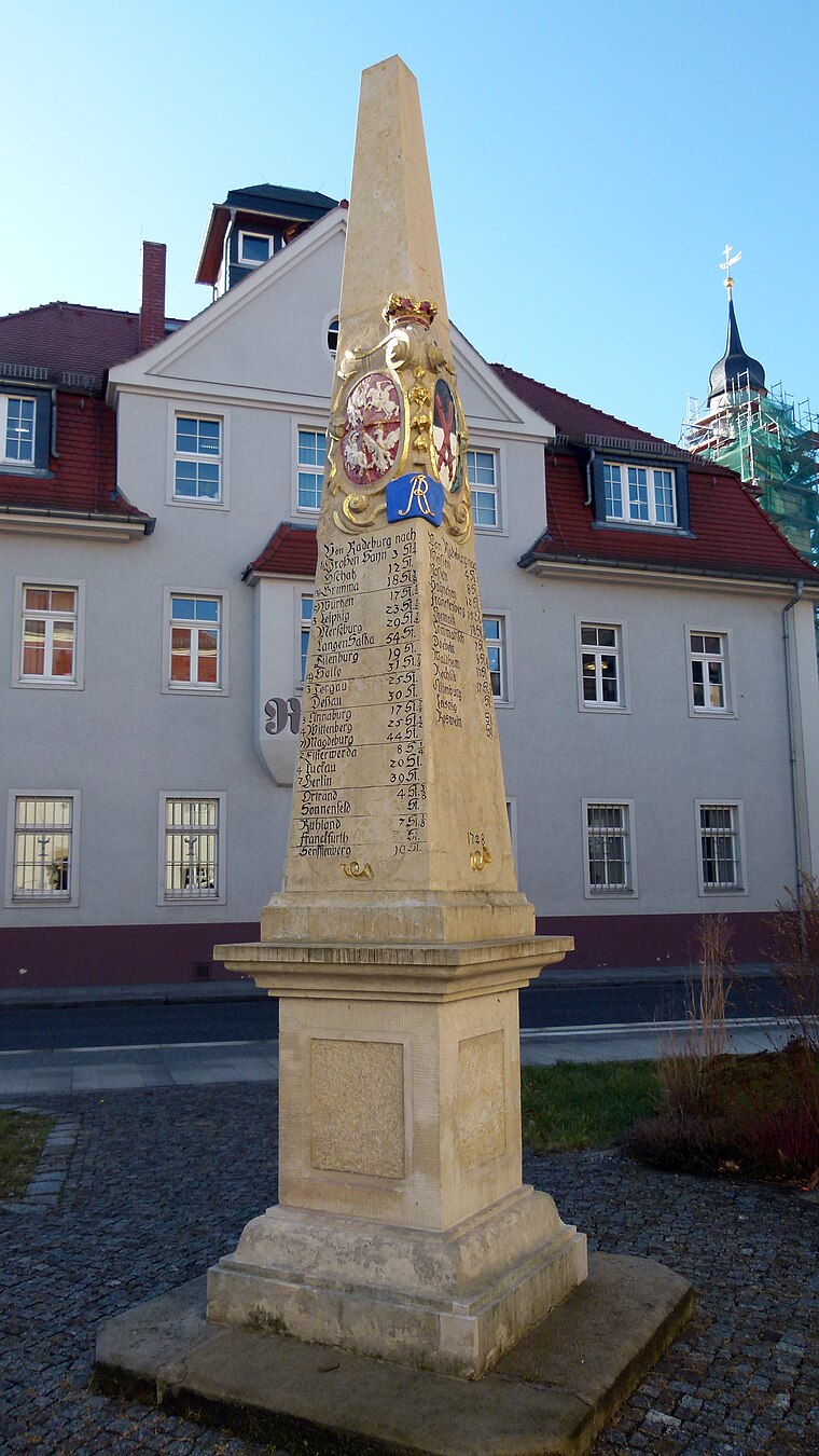
Highlights include Wildgehege Moritzburg and Polish-Saxon Post Milestone Radeburg.

Places in the Area
Nearby places include Bärwalde and Berbisdorf.


Hohberg
- Type: Peak with an elevation of 175 metres
- Categories: hill and landform
- Location: Radeburg, Meissen, Saxony, Germany, Central Europe, Europe
- View on OpenStreetMap
Latitude
51.20406° or 51° 12′ 15″ northLongitude
13.67771° or 13° 40′ 40″ eastElevation
175 metres (574 feet)Open location code
9F3M6M3H+J3OpenStreetMap ID
node 4777068560OpenStreetMap feature
natural=peak
This page is based on OpenStreetMap, GeoNames, Wikidata, and Wikimedia Commons.
We’d love your help improving our open data sources. Thank you for contributing.
Satellite Map
Discover Hohberg from above in high-definition satellite imagery.
In Other Languages
“Hohberg” goes by many names.
- Cebuano: “Hohberg”
Places with the Same Name
Discover other places named “Hohberg”.
Localities in the Area
Explore places such as Die Folgen and Ziegelei.
Notable Places Nearby
Highlights include Freiwillige Feuerwehr Bärwalde and Bärwalder Kirche.
Saxony: Must-Visit Destinations
Delve into Dresden, Leipzig, Chemnitz, and Meißen.
Curious Places to Discover
Uncover intriguing places from every corner of the globe.
About Mapcarta. Data © OpenStreetMap contributors and available under the Open Database License". Text is available under the CC BY-SA 4.0 license, except for photos, directions, and the map. Photo: Taxiarchos228, FAL.