Heideberg
Heideberg is a peak in Reichenbach, Görlitz, Saxony and has an elevation of 342 metres. Heideberg is situated nearby to the locality Waldhaus, as well as near the hamlet Lehdehäuser.| Tap on a place to explore it |
Places of Interest
Highlights include Friedersdorfer Berg and St. Ursulakirche.


Places in the Area
Nearby places include Sohland am Rotstein and Friedersdorf.
Sohland am Rotstein
Village

Photo: McBernie, CC BY-SA 3.0.
Sohland am Rotstein is a village and a former municipality in the district Görlitz, Saxony, Germany. Since 1 January 2014, it is part of the town Reichenbach.

Bernstadt auf dem Eigen
Town
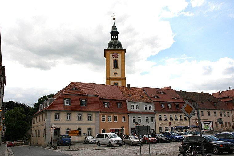
Photo: Wikimedia, CC BY-SA 3.0.
Bernstadt auf dem Eigen is a town in the Görlitz district, in Saxony, in eastern Germany. It is situated 16 km north of Zittau, and 16 km southwest of Görlitz.
Heideberg
- Type: Peak with an elevation of 342 metres
- Description: hill in Saxony, Germany - Geonames ID=2908012
- Categories: hill and landform
- Location: Reichenbach, Görlitz, Saxony, Germany, Central Europe, Europe
- View on OpenStreetMap
Latitude
51.08939° or 51° 5′ 22″ northLongitude
14.81686° or 14° 49′ 1″ eastElevation
342 metres (1,122 feet)Open location code
9F3P3RQ8+QPOpenStreetMap ID
node 12382553664OpenStreetMap feature
natural=peak
This page is based on OpenStreetMap, GeoNames, Wikidata, and Wikimedia Commons.
We’d love your help improving our open data sources. Thank you for contributing.
Satellite Map
Discover Heideberg from above in high-definition satellite imagery.
In Other Languages
From Cebuano to German—“Heideberg” goes by many names.
- Cebuano: “Heideberg”
- German: “Heideberg”
Places with the Same Name
Discover other places named “Heideberg”.
Localities in the Area
Explore places such as Waldhaus and Lehdehäuser.
Notable Places Nearby
Highlights include Spitzberg and Friedwald Markersdorf.
Saxony: Must-Visit Destinations
Delve into Dresden, Leipzig, Chemnitz, and Meißen.
Curious Places to Discover
Uncover intriguing places from every corner of the globe.
About Mapcarta. Data © OpenStreetMap contributors and available under the Open Database License". Text is available under the CC BY-SA 4.0 license, except for photos, directions, and the map. Photo: Taxiarchos228, FAL.