Grub Berg
Grub Berg is a hill in Trabitz, Neustadt an der Waldnaab, Bavaria and has an elevation of 442 metres. Grub Berg is situated nearby to the village Feilersdorf, as well as near Bärnwinkel.| Tap on a place to explore it |
Places of Interest
Highlights include Castle Weihersberg and St. Georg.
Castle Weihersberg
Castle

Photo: A. Köppl, CC BY-SA 4.0.
Castle Weihersberg is situated 3 km northeast of Grub Berg.

Franz-von-Paula-Kapelle
Church

Photo: A. Köppl, CC BY-SA 4.0.
Franz-von-Paula-Kapelle is a church, which is situated 2½ km northeast of Grub Berg.
Places in the Area
Nearby places include Pressath and Weihersberg.
Pressath
Town
 Pressath is a town in the district of Neustadt an der Waldnaab, in Bavaria, Germany. Pressath was founded in 1657. It is situated 20 km northwest of Weiden in der Oberpfalz and ca. 7 km north of Grafenwöhr. Pressath is situated 2½ km east of Grub Berg.
Weihersberg
Village
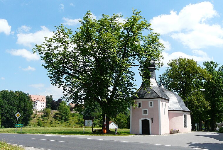
Photo: ME.Z, CC BY-SA 3.0.
Weihersberg is a village, which is situated 3 km northeast of Grub Berg.
Zessau
Village

Photo: ME.Z, CC BY-SA 4.0.
Zessau is a village, which is situated 3½ km northeast of Grub Berg.
Grub Berg
- Type: Hill with an elevation of 442 metres
- Description: hill in Germany
- Category: landform
- Location: Trabitz, Neustadt an der Waldnaab, Upper Palatinate, Bavaria, Germany, Central Europe, Europe
- View on OpenStreetMap
This page is based on GeoNames, Wikidata, and Wikimedia Commons.
We’d love your help improving our open data sources. Thank you for contributing.
Satellite Map
Discover Grub Berg from above in high-definition satellite imagery.
In Other Languages
From Cebuano to German—“Grub Berg” goes by many names.
Places with the Same Name
Discover other places named “Grub Berg”.
Localities in the Area
Explore places such as Grub and Feilersdorf.
Notable Places Nearby
Highlights include Judenberg and Moos.
Upper Palatinate: Must-Visit Destinations
Delve into Regensburg, Amberg, Cham, and Schwandorf.
Curious Places to Discover
Uncover intriguing places from every corner of the globe.
About Mapcarta. Text is available under the CC BY-SA 4.0 license, except for photos, directions, and the map. Photo: Wikimedia, CC0.