Giebel
Giebel is a farm in Emmerthal, Hameln-Pyrmont, Lower Saxony. Giebel is situated nearby to the village Amelgatzen, as well as near Welsede.| Tap on a place to explore it |
Places of Interest
Highlights include Schloss Hämelschenburg.
Schloss Hämelschenburg
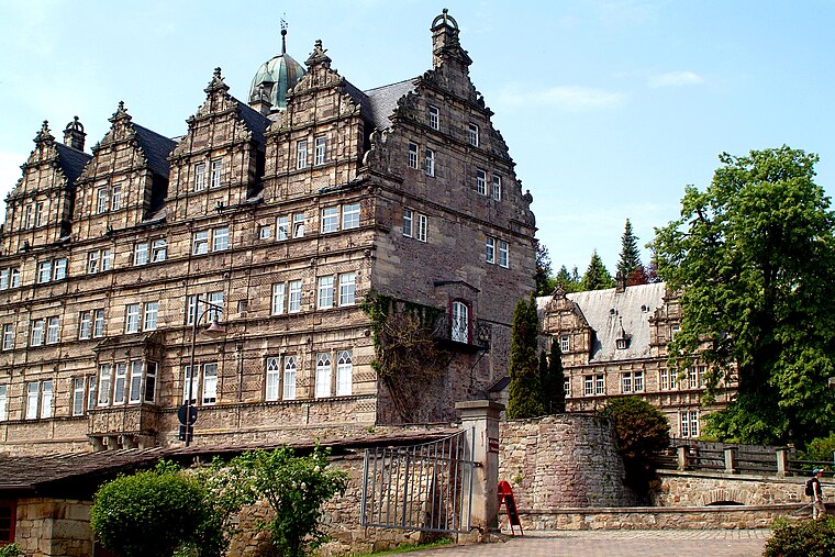
Photo: Bernd Schwabe in Hannover, CC BY-SA 3.0.
Schloss Hämelschenburg is situated 2½ km north of Giebel.
Places in the Area
Nearby places include Amelgatzen and Grohnde.

Grohnde
Village

Photo: Losch, CC BY-SA 3.0.
Grohnde is a village, which is situated 6 km east of Giebel.
Bad Pyrmont
Town

Photo: W. Bulach, CC BY-SA 4.0.
Bad Pyrmont is a town in the district of Hamelin-Pyrmont, in Lower Saxony, Germany, with a population close to 19,000. It is located on the river Emmer, about 10 km west of the Weser. Bad Pyrmont is situated 7 km west of Giebel.
Giebel
- Type: Farm
- Category: agriculture
- Location: Emmerthal, Hameln-Pyrmont, Lower Saxony, Germany, Central Europe, Europe
- View on OpenStreetMap
Latitude
52.00575° or 52° 0′ 21″ northLongitude
9.33962° or 9° 20′ 23″ eastElevation
100 metres (328 feet)Open location code
9F4F284Q+8RGeoNames ID
2920664
This page is based on GeoNames, Wikidata, and Wikimedia Commons.
We’d love your help improving our open data sources. Thank you for contributing.
Satellite Map
Discover Giebel from above in high-definition satellite imagery.
Places with the Same Name
Discover other places named “Giebel”.
Localities in the Area
Explore places such as Welsede and Hämelschenburg.
Notable Places Nearby
Highlights include Scharfen-Berg and Staatsforst Grohnde.
Lower Saxony: Must-Visit Destinations
Delve into Hanover, Göttingen, Brunswick, and Wolfsburg.
Curious Places to Discover
Uncover intriguing places from every corner of the globe.
About Mapcarta. Text is available under the CC BY-SA 4.0 license, except for photos, directions, and the map. Photo: Danapit, CC BY-SA 3.0.