Forst
Forst is a farm in Vogtareuth, Rosenheim, Bavaria. Forst is situated nearby to the hamlet Wall, as well as near Leiten.| Tap on a place to explore it |
Places of Interest
Highlights include St. Georg and Hofstätter See.

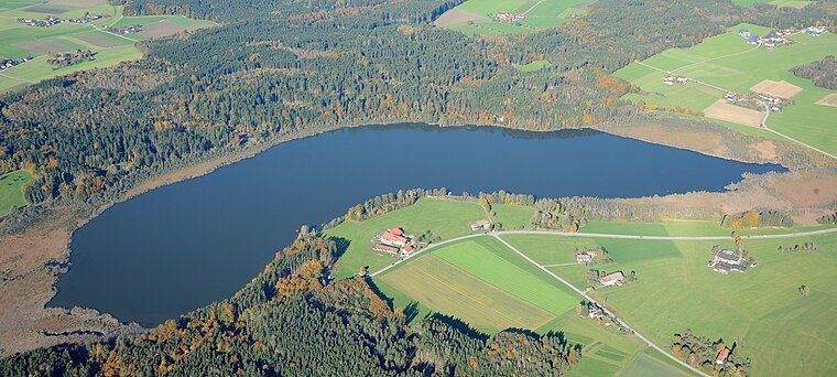
Siferlinger See
Lake

Photo: Carsten Steger, CC BY-SA 4.0.
Siferlinger See is a lake, which is situated 3 km east of Forst.
Places in the Area
Nearby places include Schwabering and Stephanskirchen.
Schwabering
Village

Photo: Sörobad, CC BY-SA 4.0.
Schwabering is a village, which is situated 4½ km southeast of Forst.
Stephanskirchen
Village

Photo: Hg6996, CC BY-SA 3.0.
Stephanskirchen is a municipality in the district of Rosenheim, Upper Bavaria in Germany. Stephanskirchen is situated 7 km south of Forst.
Großkarolinenfeld
Village

Photo: Wikimedia, Public domain.
Großkarolinenfeld is a municipality in the district of Rosenheim in Bavaria in Germany. It is located at the Munich–Rosenheim railway. The Großkarolinenfeld station is served about once per hour by local trains of the company Bayerische Regiobahn. Großkarolinenfeld is situated 8 km west of Forst.
Forst
- Type: Farm
- Category: agriculture
- Location: Vogtareuth, Rosenheim, Upper Bavaria, Bavaria, Germany, Central Europe, Europe
- View on OpenStreetMap
Latitude
47.91879° or 47° 55′ 8″ northLongitude
12.18199° or 12° 10′ 55″ eastElevation
507 metres (1,663 feet)Open location code
8FVJW59J+GQGeoNames ID
2925862
This page is based on GeoNames, Wikidata, and Wikimedia Commons.
We’d love your help improving our open data sources. Thank you for contributing.
Satellite Map
Discover Forst from above in high-definition satellite imagery.
Places with the Same Name
Discover other places named “Forst”.
Localities in the Area
Explore places such as Wall and Leiten.
Notable Places Nearby
Highlights include Rins-See and Loher Holz.
Upper Bavaria: Must-Visit Destinations
Delve into Munich, Ingolstadt, Rosenheim, and Dachau.
Curious Places to Discover
Uncover intriguing places from every corner of the globe.
About Mapcarta. Text is available under the CC BY-SA 4.0 license, except for photos, directions, and the map. Photo: Aconcagua, CC BY-SA 3.0.