Auhof
Auhof is a hamlet in Arnbruck, Regen, Bavaria. Auhof is situated nearby to the hamlet Wurz, as well as near Matzelsdorf.| Tap on a place to explore it |
Places of Interest
Highlights include St. Nikolaus and Großer Riedelstein.

Großer Riedelstein
Peak

Photo: Waldschmidt, Public domain.
At 1,132 m sea level the Großer Riedelstein is the highest point on the Kaitersberg mountain ridge in the Bavarian Forest in southern Germany. Its rocky summit is decorated by a stone monument in memory of the poet, Maximilian Schmidt, known as "Forest Schmidt". Großer Riedelstein is situated 4 km northeast of Auhof.
Arnbruck airfield
Aerodrome
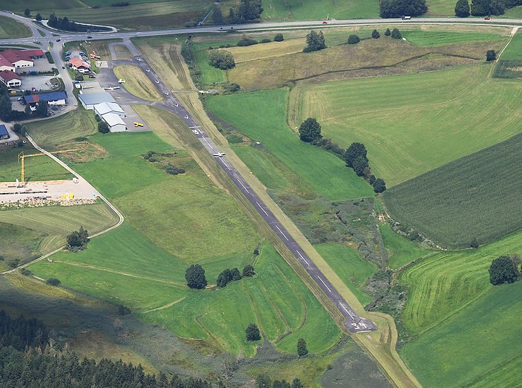
Photo: Carsten Steger, CC BY-SA 4.0.
Arnbruck airfield is an aerodrome, which is situated 3½ km southeast of Auhof.
Places in the Area
Nearby places include Drachselsried and Blossersberg.
Drachselsried
Village

Photo: Konrad Lackerbeck, CC BY 3.0.
Drachselsried is a municipality in the district of Regen, in Bavaria, Germany. Drachselsried is in the Zeller Valley, and is part of the Glass Road The area is part of the Bavarian Forest National Park. Drachselsried is situated 6 km southeast of Auhof.
Blossersberg
Village

Photo: Konrad Lackerbeck, CC0.
Blossersberg is a village, which is situated 7 km southwest of Auhof.
Arrach
Village

Photo: Konrad Lackerbeck, CC BY 3.0.
Arrach is a municipality in the district of Cham in Bavaria in Germany. It lies within the scenic valley of the Lamer Winkel. Arrach is situated 7 km northeast of Auhof.
Auhof
- Type: Hamlet
- Category: locality
- Location: Arnbruck, Regen, Lower Bavaria, Bavaria, Germany, Central Europe, Europe
- View on OpenStreetMap
Latitude
49.13792° or 49° 8′ 17″ northLongitude
12.94015° or 12° 56′ 25″ eastElevation
471 metres (1,545 feet)Open location code
8FXJ4WQR+53OpenStreetMap ID
node 355690483OpenStreetMap feature
place=hamletGeoNames ID
2954109
This page is based on OpenStreetMap, GeoNames, Wikidata, and Wikimedia Commons.
We’d love your help improving our open data sources. Thank you for contributing.
Satellite Map
Discover Auhof from above in high-definition satellite imagery.
Places with the Same Name
Discover other places named “Auhof”.
Localities in the Area
Explore places such as Wurz and Matzelsdorf.
Notable Places Nearby
Highlights include Bärnloch and Freiwilige Feuerwehr Traidersdorf.
Lower Bavaria: Must-Visit Destinations
Delve into Passau, Landshut, Straubing, and Deggendorf.
Curious Places to Discover
Uncover intriguing places from every corner of the globe.
About Mapcarta. Data © OpenStreetMap contributors and available under the Open Database License". Text is available under the CC BY-SA 4.0 license, except for photos, directions, and the map. Photo: Wikimedia, CC0.