Hofortl
Hofortl is a field in Burgenland, Austria. Hofortl is situated nearby to the village Podersdorf am See, as well as near Gols.| Tap on a place to explore it |
Places of Interest
Highlights include Podersdorf lighthouse and Kath. Pfarrkirche hl. Katharina, Podersdorf am See.

Kath. Pfarrkirche hl. Katharina, Podersdorf am See
Church

Photo: Braveheart, CC BY-SA 4.0.
Kath. Pfarrkirche hl. Katharina, Podersdorf am See is a church.
Dreifaltigkeitssäule, Podersdorf am See
Memorial

Photo: Bwag, CC BY-SA 3.0.
Dreifaltigkeitssäule, Podersdorf am See is a memorial.
Places in the Area
Nearby places include Gols and Neusiedl am See.
Gols
Village

Photo: Steindy, CC BY-SA 4.0.
Gols is a town in the district of Neusiedl am See in the Austrian state of Burgenland. Gols is situated 6 km northeast of Hofortl.
Neusiedl am See

Photo: Robert Heilinger, CC BY-SA 3.0.
Neusiedl am See is a city in the province of Burgenland in Austria, on the northern shore of the Neusiedler See.
Halbturn
Village
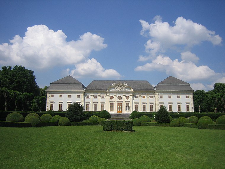
Photo: BambooBeast, Public domain.
Halbturn is a town in the district of Neusiedl am See in the Austrian state of Burgenland. It borders Hungary to the east and is near Andau, Gols, and Mönchof. Halbturn is situated 10 km east of Hofortl.
Hofortl
- Type: Field
- Location: Burgenland, Austria, Central Europe, Europe
- View on OpenStreetMap
Latitude
47.86639° or 47° 51′ 59″ northLongitude
16.84333° or 16° 50′ 36″ eastElevation
116 metres (381 feet)Open location code
8FVRVR8V+H8GeoNames ID
3337255
This page is based on GeoNames, Wikidata, and Wikimedia Commons.
We’d love your help improving our open data sources. Thank you for contributing.
Satellite Map
Discover Hofortl from above in high-definition satellite imagery.
Localities in the Area
Explore places such as Podersdorf am See and Gols.
Notable Places Nearby
Highlights include Sechsmahdhügel and Georgshof.
Burgenland: Must-Visit Destinations
Delve into Eisenstadt, Neusiedl am See, Rust, and Güssing.
Curious Fields to Discover
Uncover intriguing fields from every corner of the globe.
About Mapcarta. Text is available under the CC BY-SA 4.0 license, except for photos, directions, and the map. Photo: Wikimedia, CC BY-SA 4.0.