Quebrada El Remolino
Quebrada El Remolino is a stream in Santa Bárbara Department, Honduras. Quebrada El Remolino is situated nearby to the locality Tegucigalpita, as well as near San Juan.| Tap on a place to explore it |
Places in the Area
Nearby places include Santa Rita and San Francisco de Ojuera.
Santa Rita
Town
Santa Rita is a municipality in the Honduran department of Santa Bárbara. Santa Rita is situated 2½ km west of Quebrada El Remolino.
San Francisco de Ojuera
Town
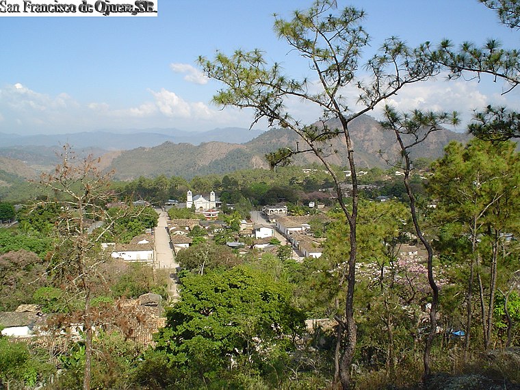
Photo: 1ednp, CC BY-SA 2.5.
San Francisco de Ojuera is a municipality in the Honduran department of Santa Bárbara. San Francisco de Ojuera is situated 5 km southeast of Quebrada El Remolino.
Ceguaca
Town
Ceguaca is a municipality in the Honduran department of Santa Bárbara. Ceguaca is situated 5 km northeast of Quebrada El Remolino.
Quebrada El Remolino
- Type: Stream
- Category: body of water
- Location: Santa Bárbara Department, Honduras, Central America, North America
- View on OpenStreetMap
Latitude
14.76667° or 14° 46′ northLongitude
-88.23333° or 88° 14′ westElevation
418 metres (1,371 feet)Open location code
766HQQ88+MMGeoNames ID
3610530
This page is based on GeoNames, Wikidata, and Wikimedia Commons.
We’d love your help improving our open data sources. Thank you for contributing.
Satellite Map
Discover Quebrada El Remolino from above in high-definition satellite imagery.
Places with the Same Name
Discover other places named “Quebrada El Remolino”.
Localities in the Area
Explore places such as Tegucigalpita and San Juan.
Notable Places Nearby
Highlights include Cerro El Cutal and El Caliche.
Honduras: Must-Visit Destinations
Delve into Tegucigalpa, San Pedro Sula, Roatán, and La Ceiba.
Curious Streams to Discover
Uncover intriguing streams from every corner of the globe.
About Mapcarta. Text is available under the CC BY-SA 4.0 license, except for photos, directions, and the map. Photo: Wikimedia, CC0.