El Roble
El Roble is a village in Tovar Municipality, Aragua and has an elevation of 1,341 metres. El Roble is situated nearby to the village Hernandez, as well as near El Cedral.| Tap on a place to explore it |
Places in the Area
Nearby places include Colonia Tovar.
Colonia Tovar
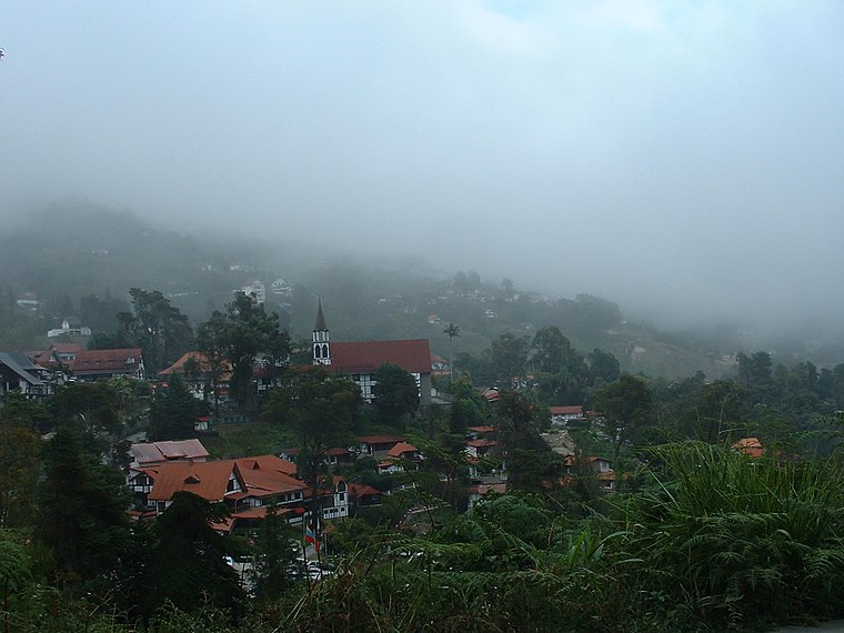
Photo: Pderuvo, CC BY-SA 3.0.
Colonia Tovar is a small town in Central Venezuela's Aragua state. It is unique for its remarkable German heritage and beautiful mountainside setting.
El Roble
- Type: Village
- Category: locality
- Location: Tovar Municipality, Aragua, Venezuela, South America
- View on OpenStreetMap
Latitude
10.37671° or 10° 22′ 36″ northLongitude
-67.22506° or 67° 13′ 30″ westElevation
1,341 metres (4,400 feet)Open location code
772J9QGF+MXOpenStreetMap ID
node 5737220822OpenStreetMap feature
place=villageGeoNames ID
3806753
This page is based on OpenStreetMap, GeoNames, Wikidata, and Wikimedia Commons.
We’d love your help improving our open data sources. Thank you for contributing.
Satellite Map
Discover El Roble from above in high-definition satellite imagery.
Places with the Same Name
Discover other places named “El Roble”.
Localities in the Area
Explore places such as Hernandez and El Cedral.
Notable Places Nearby
Highlights include Topo El Roble and Cerro El Palmar.
Venezuela: Must-Visit Destinations
Delve into Caracas, Mérida, Maracaibo, and Táchira.
Curious Places to Discover
Uncover intriguing places from every corner of the globe.
About Mapcarta. Data © OpenStreetMap contributors and available under the Open Database License". Text is available under the CC BY-SA 4.0 license, except for photos, directions, and the map. Photo: Venex, CC BY-SA 3.0.