Bethel African Methodist Episcopal Church
Bethel African Methodist Episcopal Church is a church in Town of Stamford, Western Connecticut Planning Region, Connecticut. Bethel African Methodist Episcopal Church is situated nearby to the work of art Stamford Cone, as well as near the railway station Stamford Station.| Tap on a place to explore it |
Places of Interest Nearby
Highlights include Stamford Station and Stamford Hospital.
Stamford Station
Railway station

Photo: Pi.1415926535, CC BY-SA 3.0.
Stamford station, officially known as the Stewart B. McKinney Transportation Center or the Stamford Transportation Center, is a major railroad station in the city of Stamford, Connecticut, serving passengers traveling on Metro-North Railroad's New Haven Line, and Amtrak's Northeast Corridor. Stamford Station is situated 2,500 feet east of Bethel African Methodist Episcopal Church.
Stamford Hospital
Hospital
Stamford Hospital, residing on the Bennett Medical Center campus, is a 305-bed, not-for-profit hospital and the central facility for Stamford Health. The hospital is the regional healthcare facility for Fairfield and Westchester counties, and is the only hospital in the city of Stamford, Connecticut. Stamford Hospital is situated 2,900 feet north of Bethel African Methodist Episcopal Church.
Stamford Cone
Work of art

Photo: Carol M. Highsmith, Public domain.
The Stamford Cone is a 14-metre-high stained glass pavilion, commissioned from the artist Brian Clarke as a site-specific artwork for the headquarters of UBS AG and landmark feature for the city of Stamford, Connecticut in the United States. Stamford Cone is situated 2,300 feet east of Bethel African Methodist Episcopal Church.
Places in the Area
Nearby places include Stamford and South End of Stamford.
Stamford

Photo: John9474, CC BY-SA 4.0.
Stamford, Connecticut is the fourth largest city in the state, a center of regional activity in Fairfield County, and a hub of the Metro New York area.
South End of Stamford
Hamlet

Photo: Noroton, Public domain.
The South End of Stamford, Connecticut is a neighborhood located at the southern end of the city, just south of the Downtown neighborhood. The South End is a peninsula bordered by Downtown Stamford and Interstate 95 to the north and almost totally by water on all other sides, with few streets linking it to other neighborhoods.
Old Greenwich
Village
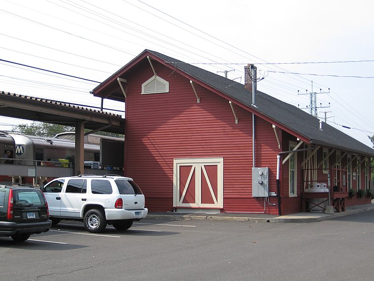
Photo: Noroton, Public domain.
Old Greenwich is a coastal village in Fairfield County, Connecticut, United States. As of the 2010 census it had a population of 6,611. The town of Greenwich is one political and taxing body, but consists of several distinct sections or neighborhoods, such as Byram, Cos Cob, Glenville, Mianus, Old Greenwich, Riverside, and Greenwich.
Bethel African Methodist Episcopal Church
- Type: Church
- Categories: place of worship and religion
- Location: Town of Stamford, Western Connecticut Planning Region, Connecticut, New England, United States, North America
- View on OpenStreetMap
Latitude
41.04667° or 41° 2′ 48″ northLongitude
-73.55071° or 73° 33′ 3″ westElevation
85 feet (26 metres)Open location code
87H82CWX+MPOpenStreetMap ID
node 359285264OpenStreetMap feature
amenity=place_of_worshipGeoNames ID
5282295
This page is based on OpenStreetMap, GeoNames, Wikidata, and Wikimedia Commons.
We’d love your help improving our open data sources. Thank you for contributing.
Satellite Map
Discover Bethel African Methodist Episcopal Church from above in high-definition satellite imagery.
Places with the Same Name
Discover other places named “Bethel African Methodist Episcopal Church”.
Localities in the Area
Explore places such as Northfield and Ridgeway.
Nearby Places
Explore places such as Yerwood Center and Stanford Auto Body Shop.
Connecticut: Must-Visit Destinations
Delve into Hartford, New Haven, Bridgeport, and Stamford.
Curious Churches to Discover
Uncover intriguing churches from every corner of the globe.
About Mapcarta. Data © OpenStreetMap contributors and available under the Open Database License". Text is available under the CC BY-SA 4.0 license, except for photos, directions, and the map. Photo: Wikimedia, CC0.