Bethel African Methodist Episcopal Church
Bethel African Methodist Episcopal Church is a church in Town of Norwalk, Western Connecticut Planning Region, Connecticut. Bethel African Methodist Episcopal Church is situated nearby to Stepping Stones Museum for Children, as well as near Lockwood-Mathews Mansion Museum.| Tap on a place to explore it |
Places of Interest Nearby
Highlights include Stepping Stones Museum for Children and Lockwood-Mathews Mansion Museum.
Stepping Stones Museum for Children
Museum

Photo: Noroton, Public domain.
The Stepping Stones Museum for Children is a hands-on museum specifically designed for children aged 10 and under. It is situated at 303 West Avenue within the Central district of Norwalk, Connecticut. Stepping Stones Museum for Children is situated 1,200 feet southwest of Bethel African Methodist Episcopal Church.
Lockwood-Mathews Mansion Museum
Museum

Photo: Noroton, CC BY-SA 3.0.
The Lockwood–Mathews Mansion is a Second Empire style country house in Norwalk, Connecticut. Now a museum, it was built in 1864-68 for railroad and banking magnate LeGrand Lockwood. Lockwood-Mathews Mansion Museum is situated 1,800 feet southwest of Bethel African Methodist Episcopal Church.
Norwalk Hospital
Hospital

Photo: Noroton, Public domain.
Norwalk Hospital is a not-for-profit, acute care community teaching hospital in the Hospital Hill section of Norwalk, Connecticut. The hospital serves a population of 250,000 in lower Fairfield County, Connecticut. Norwalk Hospital is situated 2,500 feet west of Bethel African Methodist Episcopal Church.
Places in the Area
Nearby places include Norwalk and East Norwalk.
Norwalk
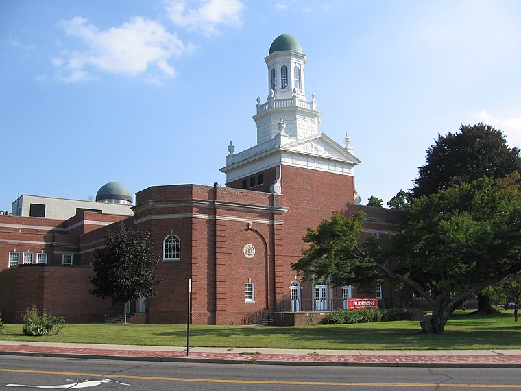
Photo: Noroton, CC BY-SA 3.0.
Norwalk is a city of 91,000 people in Fairfield County, in the state of Connecticut in the United States of America. It includes the villages of: East Norwalk, West Norwalk, Cranbury, Silvermine, Winnipauk, Wilson Point, Harbor View, Rowayton and South Norwalk, known locally as "SoNo." Norwalk, probably due mostly to its proximity to New York City, is home to many large companies.
East Norwalk
Village

Photo: StephenTS42, CC BY-SA 4.0.
East Norwalk is a neighborhood of Norwalk, Connecticut, United States. It is located mostly in Norwalk's third taxing district with segments of its northernmost area within the first and fifth taxing districts.
South Norwalk
Suburb
South Norwalk is a neighborhood in Norwalk, Connecticut which corresponds to the city's Second Taxing District. Often referred to as SoNo, the neighborhood was originally settled as Old Well, then chartered as the city of South Norwalk on August 18, 1870.
Bethel African Methodist Episcopal Church
- Type: Church
- Denomination: Methodist
- Categories: building, place of worship, and religion
- Location: Town of Norwalk, Western Connecticut Planning Region, Connecticut, New England, United States, North America
- View on OpenStreetMap
Latitude
41.1128° or 41° 6′ 46″ northLongitude
-73.41336° or 73° 24′ 48″ westElevation
30 feet (9 metres)Open location code
87H84H7P+4MOpenStreetMap ID
way 597067384OpenStreetMap feature
amenity=place_of_worshipOpenStreetMap feature
building=yesOpenStreetMap attribute
denomination=methodistGeoNames ID
5282300
This page is based on OpenStreetMap, GeoNames, Wikidata, and Wikimedia Commons.
We’d love your help improving our open data sources. Thank you for contributing.
Satellite Map
Discover Bethel African Methodist Episcopal Church from above in high-definition satellite imagery.
Places with the Same Name
Discover other places named “Bethel African Methodist Episcopal Church”.
Localities in the Area
Explore places such as Winnipauk Village and Shorehaven.
Nearby Places
Explore places such as Curries Tire and Auto and European Auto Center Repair.
Connecticut: Must-Visit Destinations
Delve into Hartford, New Haven, Bridgeport, and Stamford.
Curious Churches to Discover
Uncover intriguing churches from every corner of the globe.
About Mapcarta. Data © OpenStreetMap contributors and available under the Open Database License". Text is available under the CC BY-SA 4.0 license, except for photos, directions, and the map. Photo: Wikimedia, CC0.