Río Poyor
Río Poyor is a stream in Ancash, Peru and has an elevation of 2,753 metres. Río Poyor is situated nearby to the village Yungar, as well as near the hamlet Carián.| Tap on a place to explore it |
Places of Interest
Highlights include Comandante FAP Germán Arias Graziani Airport.
Comandante FAP Germán Arias Graziani Airport
Aerodrome
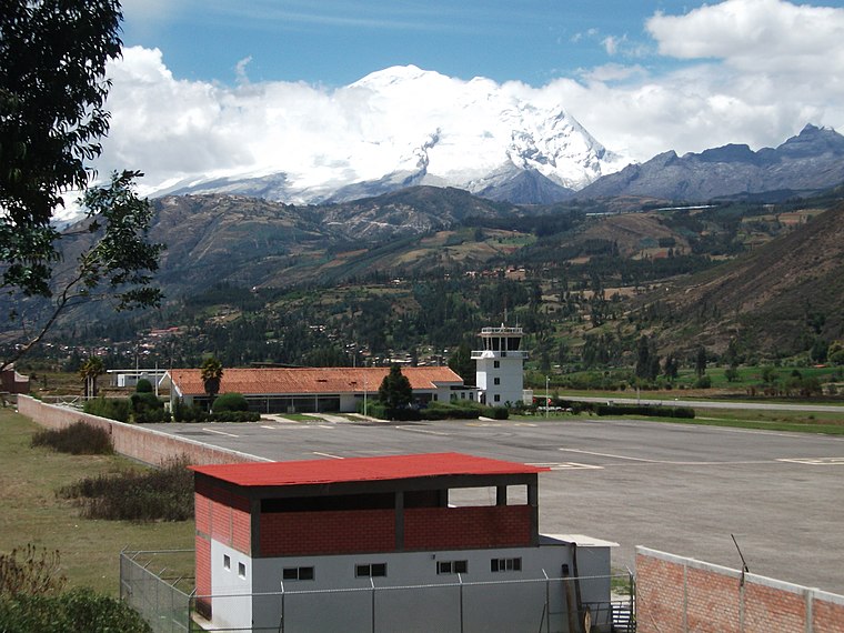
Photo: Suizaperuana, CC BY-SA 3.0.
Comandante FAP Germán Arias Graziani Airport is a regional airport serving the city of Huaraz, Ancash Region, Peru. The airport is in the Santa River valley, 20 kilometres northwest of Huaraz, at the village of Anta. Comandante FAP Germán Arias Graziani Airport is situated 3 km northwest of Río Poyor.
Río Poyor
- Type: Stream
- Also known as: “Rio Poyor”
- Category: body of water
- Location: Ancash, Peru, South America
- View on OpenStreetMap
Latitude
-9.37417° or 9° 22′ 27″ southLongitude
-77.58528° or 77° 35′ 7″ westElevation
2,753 metres (9,032 feet)Open location code
6724JCG7+8VGeoNames ID
6380381
This page is based on GeoNames, Wikidata, and Wikimedia Commons.
We’d love your help improving our open data sources. Thank you for contributing.
Satellite Map
Discover Río Poyor from above in high-definition satellite imagery.
Localities in the Area
Explore places such as Yungar and Carián.
Notable Places Nearby
Highlights include Cerro Aparac and Cerro Huanto Jirca.
Peru: Must-Visit Destinations
Delve into Lima, Machu Picchu, Cuzco, and Arequipa.
Curious Streams to Discover
Uncover intriguing streams from every corner of the globe.
About Mapcarta. Text is available under the CC BY-SA 4.0 license, except for photos, directions, and the map. Photo: Wikimedia, CC0.