Lliuya
Lliuya is a locality in Ripán District, Province of Dos de Mayo, Huánuco Department and has about 79 residents and an elevation of 3,940 metres. Lliuya is situated nearby to the hamlet Pampa Esperanza, as well as near the locality Chogolagran.| Tap on a place to explore it |
Places in the Area
Nearby places include La Unión.
La Unión
Town
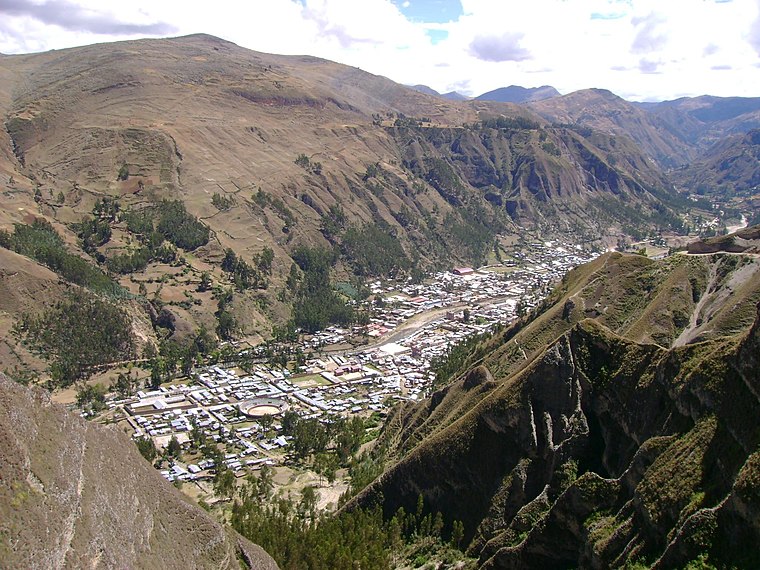 La Unión is a town in central Peru, capital of the province Dos de Mayo in the region Huánuco. The city lies over the Vizcarra River and is divided between two of the nine districts of the province, La Unión on the right bank and Ripán on the left bank. La Unión is situated 8 km east of Lliuya.
Lliuya
- Type: Locality with 79 residents
- Location: Ripán District, Province of Dos de Mayo, Huánuco Department, Peru, South America
- View on OpenStreetMap
Latitude
-9.81174° or 9° 48′ 42″ southLongitude
-76.86807° or 76° 52′ 5″ westPopulation
79Elevation
3,940 metres (12,927 feet)Open location code
672554QJ+8QGeoNames ID
6666019
This page is based on GeoNames, Wikidata, and Wikimedia Commons.
We’d love your help improving our open data sources. Thank you for contributing.
Satellite Map
Discover Lliuya from above in high-definition satellite imagery.
Localities in the Area
Explore places such as Pampa Esperanza and Chogolagran.
Notable Places Nearby
Highlights include Cerro Yanajanca and Cerro Mina Ucro.
Peru: Must-Visit Destinations
Delve into Lima, Machu Picchu, Cuzco, and Arequipa.
Curious Places to Discover
Uncover intriguing places from every corner of the globe.
About Mapcarta. Text is available under the CC BY-SA 4.0 license, except for photos, directions, and the map. Photo: Wikimedia, CC BY 3.0.