Montsevelier, village
Montsevelier, village is a bus stop in Val Terbi, Delémont District, Canton of Jura. Montsevelier, village is situated nearby to the village Grindel, as well as near Corban.| Tap on a place to explore it |
Places of Interest Nearby
Highlights include Neu-Thierstein Castle and Neuenstein Castle.
Neu-Thierstein Castle
Castle
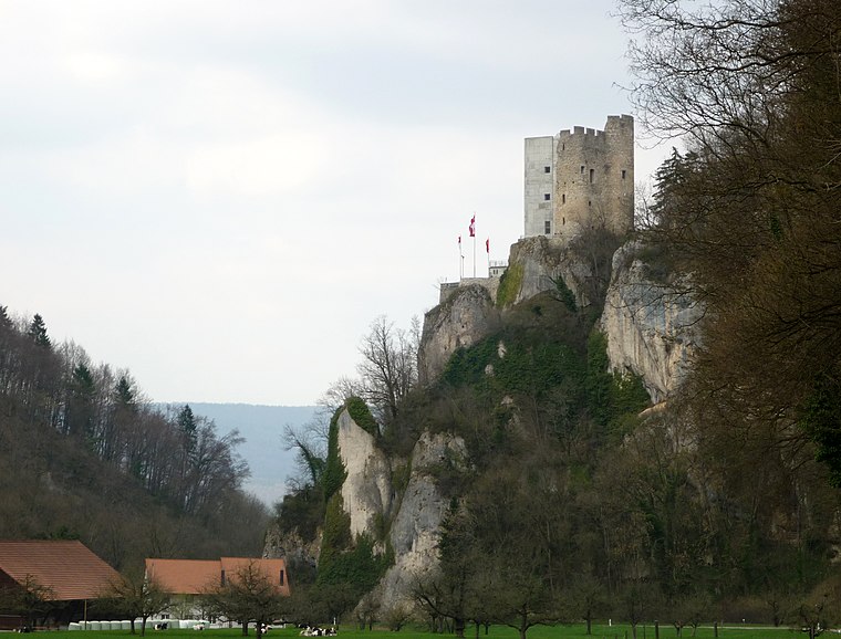
Photo: Gestumblindi, CC0.
Neu-Thierstein Castle is a ruined castle in the Swiss municipality of Büsserach in the canton of Solothurn, Switzerland. Neu-Thierstein Castle is situated 3½ km northeast of Montsevelier, village.
Neuenstein Castle
Archaeological site

Photo: Kvgunten, CC BY-SA 4.0.
Neuenstein Castle is an archaeological site, which is situated 3½ km north of Montsevelier, village.
Ruine Bännlifels
Archaeological site

Photo: Kvgunten, CC BY-SA 4.0.
Ruine Bännlifels is an archaeological site, which is situated 3 km north of Montsevelier, village.
Places in the Area
Nearby places include Grindel and Corban.
Grindel
Village

Photo: Gestumblindi, CC BY-SA 4.0.
Grindel is a municipality in the district of Thierstein in the canton of Solothurn in Switzerland.
Corban
Village

Photo: DidiWeidmann, CC BY-SA 3.0.
Corban is a former municipality in the district of Delémont in the canton of Jura in Switzerland. On 1 January 2018 the former municipality of Corban merged into the municipality of Val Terbi. Corban is situated 3 km southwest of Montsevelier, village.
Erschwil
Village

Photo: Minnou, CC BY-SA 3.0.
Erschwil is a municipality in the district of Thierstein in the canton of Solothurn in Switzerland. Erschwil is situated 3 km northeast of Montsevelier, village.
Montsevelier, village
- Type: Bus stop
- Also known as: “Montsevelier Village”
- Categories: transport stop and transportation
- Location: Val Terbi, Delémont District, Canton of Jura, Switzerland, Central Europe, Europe
- View on OpenStreetMap
Latitude
47.36047° or 47° 21′ 38″ northLongitude
7.50633° or 7° 30′ 23″ eastElevation
567 metres (1,860 feet)Operator
PAGNetwork
VagabondOpen location code
8FV99G64+5GOpenStreetMap ID
node 11626424755OpenStreetMap feature
public_transport=stop_positionGeoNames ID
10387238
This page is based on OpenStreetMap, GeoNames, Wikidata, and Wikimedia Commons.
We’d love your help improving our open data sources. Thank you for contributing.
Satellite Map
Discover Montsevelier, village from above in high-definition satellite imagery.
In Other Languages
“Montsevelier, village” goes by many names.
- French: “Montsevelier, village”
Localities in the Area
Explore places such as Montsevelier and Rière Chaumai.
Nearby Places
Explore places such as Montsevelier Village and Montsevelier Village.
Switzerland: Must-Visit Destinations
Delve into Zurich, Berne, Geneva, and Basel.
Curious Bus Stops to Discover
Uncover intriguing bus stops from every corner of the globe.
About Mapcarta. Data © OpenStreetMap contributors and available under the Open Database License". Text is available under the CC BY-SA 4.0 license, except for photos, directions, and the map. Photo: Simonizer, CC BY-SA 2.0 de.