Rachhiālu
Rachhiālu is a village in Shahpur, Kangra, Himachal Pradesh. Rachhiālu is situated nearby to the village Sandaur, as well as near Keori.| Tap on a place to explore it |
Places of Interest
Highlights include Kangra Airport.
Kangra Airport
Aerodrome
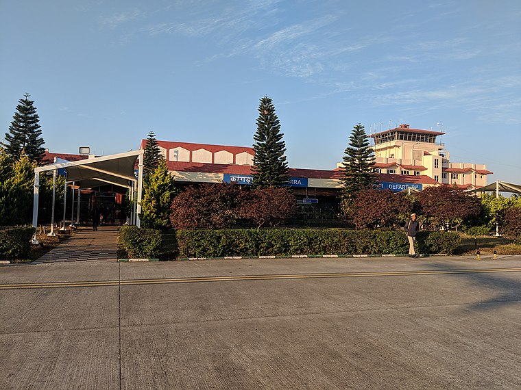
Photo: FaramRK, CC BY-SA 4.0.
Kangra-Gaggal Airport, officially known as Kangra Airport, is a domestic airport serving areas of Kangra including Dharamshala, the winter capital of Himachal Pradesh, India.
Places in the Area
Nearby places include Kangra and Dharamsala.
Kangra
 Kangra is a city and a municipal council in Kangra district in the Indian state of Himachal Pradesh. It is also known as Nagarkot.
Dharamsala

Photo: Jms1241, CC BY-SA 4.0.
Dharamsala, is a hill station in Himachal Pradesh, famed for its large Tibetan community centred on the activities of the Dalai Lama.
Sidhbari

Photo: Planemad, CC BY-SA 3.0.
Sidhbari is a scenic village and bazaar on the outskirts of Lower Dharamshala along the feet of the Himalayan Dhauladhar mountain range in the Indian state of Himachal Pradesh.
Rachhiālu
- Type: Village
- Also known as: “Rachhialu”
- Category: locality
- Location: Shahpur, Kangra, Himachal Pradesh, India, South Asia, Asia
- View on OpenStreetMap
Latitude
32.16655° or 32° 9′ 60″ northLongitude
76.26864° or 76° 16′ 7″ eastElevation
770 metres (2,526 feet)Open location code
8J4R5789+JFOpenStreetMap ID
node 8621231400OpenStreetMap feature
place=villageGeoNames ID
10722978
This page is based on OpenStreetMap, GeoNames, Wikidata, and Wikimedia Commons.
We’d love your help improving our open data sources. Thank you for contributing.
Satellite Map
Discover Rachhiālu from above in high-definition satellite imagery.
Localities in the Area
Explore places such as Sandaur and Keori.
Notable Places Nearby
Highlights include Main Temple and Temple.
Kangra: Must-Visit Destinations
Delve into Dharamsala, Bir, Kangra, and Jawalamukhi.
Curious Places to Discover
Uncover intriguing places from every corner of the globe.
About Mapcarta. Data © OpenStreetMap contributors and available under the Open Database License". Text is available under the CC BY-SA 4.0 license, except for photos, directions, and the map. Photo: Wikimedia, CC0.