Instituto Nacional para el Desarrollo Cooperativo Cebadilla
Instituto Nacional para el Desarrollo Cooperativo Cebadilla is a locality in Tapachula Municipality, Chiapas. Instituto Nacional para el Desarrollo Cooperativo Cebadilla is situated nearby to the locality Nuevo Mundo I, as well as near Pintoresco.| Tap on a place to explore it |
Places of Interest
Highlights include Estadio Olímpico de Tapachula.
Estadio Olímpico de Tapachula
Stadium
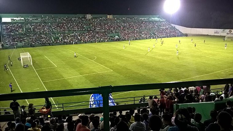
Photo: AdrianArrazola, CC BY-SA 4.0.
Estadio Olímpico de Tapachula is a multi-purpose stadium in Tapachula, Chiapas, Mexico. It is currently used mostly for football matches. The stadium seats 18,017 people. Estadio Olímpico de Tapachula is situated 3 km west of Instituto Nacional para el Desarrollo Cooperativo Cebadilla.
Places in the Area
Nearby places include Tapachula.
Tapachula
 Tapachula de Córdova y Ordóñez or simply Tapachula is a city of 320,000 people in Chiapas. Tapachula is Mexico's main border city with Guatemala on the Pacific coast area although it is some kilometers away from the border.
Instituto Nacional para el Desarrollo Cooperativo Cebadilla
- Type: Locality
- Location: Tapachula Municipality, Chiapas, Yucatán and the South, Mexico, North America
- View on OpenStreetMap
Latitude
14.87741° or 14° 52′ 39″ northLongitude
-92.26403° or 92° 15′ 51″ westElevation
132 metres (433 feet)Open location code
7669VPGP+X9GeoNames ID
11009731
This page is based on GeoNames, Wikidata, and Wikimedia Commons.
We’d love your help improving our open data sources. Thank you for contributing.
Satellite Map
Discover Instituto Nacional para el Desarrollo Cooperativo Cebadilla from above in high-definition satellite imagery.
In Other Languages
“Instituto Nacional para el Desarrollo Cooperativo Cebadilla” goes by many names.
- Spanish: “INDECO Cebadilla”
- Spanish: “Instituto Nacional para el Desarrollo Cooperativo Cebadilla”
Localities in the Area
Explore places such as Nuevo Mundo I and Pintoresco.
Notable Places Nearby
Highlights include Archaeological Museum of Soconusco and Estación Veintidos de Mayo.
Chiapas: Must-Visit Destinations
Delve into Palenque, Tuxtla Gutiérrez, San Cristóbal de las Casas, and Tapachula.
Curious Places to Discover
Uncover intriguing places from every corner of the globe.
About Mapcarta. Text is available under the CC BY-SA 4.0 license, except for photos, directions, and the map. Photo: Darij & Ana, CC BY 2.0.