Fontana
Fontana is a house in Buseno, Region Moesa, Graubünden and has an elevation of 838 metres. Fontana is situated nearby to the hamlet Buseno, as well as near the peak Piz de Molinera.| Tap on a place to explore it |
Places of Interest Nearby
Highlights include Piz de Molinera and Pala Castle.
Piz de Molinera
Peak
Piz de Molinera is a mountain in the Lepontine Alps, located on the border between the cantons of Ticino and Graubünden. It overlooks the junction of the Ticino and the Moesa, north of Arbedo. Piz de Molinera is situated 2½ km west of Fontana.
Pala Castle
Castle
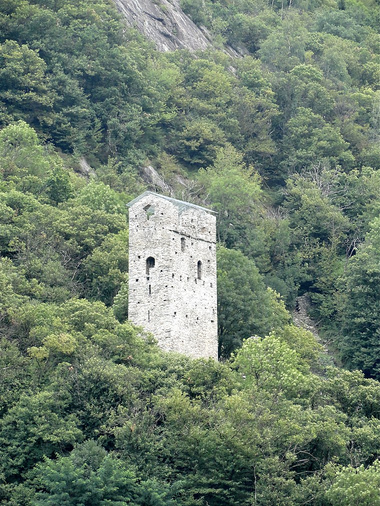
Photo: Parpan05, CC BY-SA 3.0.
Pala Castle is a tower in the municipality of San Vittore of the Canton of Graubünden in Switzerland. It is a Swiss heritage site of national significance. Pala Castle is situated 3 km south of Fontana.
Santa Maria in Calanca Castle
Castle

Photo: Parpan05, CC BY-SA 3.0.
Santa Maria in Calanca Castle is a tower in the municipality of Santa Maria in Calanca of the Canton of Graubünden in Switzerland. It, along with the neighboring Church of the Assumption of St. Mary, are both Swiss heritage sites of national significance. Santa Maria in Calanca Castle is situated 3 km east of Fontana.
Places in the Area
Nearby places include Buseno and Castaneda.
Buseno
Hamlet

Photo: Parpan05, CC BY-SA 3.0.
Buseno is a municipality in the Moesa Region in the Swiss canton of the Grisons.
Castaneda
Village

Photo: Parpan05, CC BY-SA 3.0.
Castaneda is a municipality in the Moesa Region in the Swiss canton of the Grisons. Castaneda is situated 3 km east of Fontana.
Santa Maria in Calanca
Village

Photo: Wikimedia, CC BY-SA 3.0.
Santa Maria in Calanca is a municipality in the Moesa Region in the Swiss canton of the Grisons. Santa Maria in Calanca is situated 3 km east of Fontana.
Fontana
- Type: House
- Categories: residential building and building
- Location: Buseno, Region Moesa, Graubünden, Switzerland, Central Europe, Europe
- View on OpenStreetMap
Latitude
46.26578° or 46° 15′ 57″ northLongitude
9.10599° or 9° 6′ 22″ eastElevation
838 metres (2,749 feet)Open location code
8FRF7484+89GeoNames ID
11220020
This page is based on GeoNames, Wikidata, and Wikimedia Commons.
We’d love your help improving our open data sources. Thank you for contributing.
Satellite Map
Discover Fontana from above in high-definition satellite imagery.
In Other Languages
“Fontana” goes by many names.
- Italian: “Fontana”
Places with the Same Name
Discover other places named “Fontana”.
Localities in the Area
Explore places such as Castaneda and San Vittore.
Nearby Places
Explore places such as Aurel and Buseno, Paese.
Graubünden: Must-Visit Destinations
Delve into Davos, Chur, St. Moritz, and Arosa.
Curious Houses to Discover
Uncover intriguing houses from every corner of the globe.
About Mapcarta. Text is available under the CC BY-SA 4.0 license, except for photos, directions, and the map. Photo: Martingarten, CC BY-SA 3.0.