Le Laret
Le Laret is a house in Siviriez, Glâne District, Canton of Fribourg and has an elevation of 801 metres. Le Laret is situated nearby to the village Vuisternens-devant-Romont, as well as near Brenles.| Tap on a place to explore it |
Places of Interest Nearby
Highlights include Vauderens railway station and Saint-Loup parish church.
Vauderens railway station
Railway station
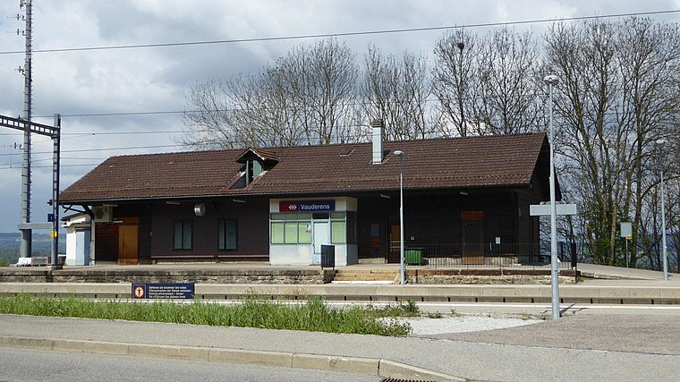 Vauderens railway station is a railway station in the municipality of Ursy, in the Swiss canton of Fribourg. It is an intermediate stop on the standard gauge Lausanne–Bern line of Swiss Federal Railways. Vauderens railway station is situated 4 km southwest of Le Laret.
Saint-Loup parish church
Church

Photo: WWHenderson20, CC BY-SA 3.0.
Saint-Loup parish church is situated 4 km south of Le Laret.
Jacques Dénervaud’s farmhouse
Building

Photo: WWHenderson20, CC BY-SA 3.0.
Jacques Dénervaud’s farmhouse is a building, which is situated 3½ km southwest of Le Laret.
Places in the Area
Nearby places include Vuisternens-devant-Romont and Brenles.
Vuisternens-devant-Romont
Village

Photo: FotoRots.ch, CC BY-SA 3.0.
Vuisternens-devant-Romont is a municipality in the district of Glâne in the canton of Fribourg in Switzerland. Vuisternens-devant-Romont is situated 3 km east of Le Laret.
Brenles
Village

Photo: Christophe95, CC BY-SA 3.0.
Brenles is a former municipality in the district Broye-Vully in the canton of Vaud in Switzerland. In 2017 the former municipalities of Brenles, Chesalles-sur-Moudon, Cremin, Forel-sur-Lucens and Sarzens merged into the municipality of Lucens. Brenles is situated 4½ km northwest of Le Laret.
Ursy
Village

Photo: Wikimedia, CC BY-SA 3.0.
Ursy is a municipality in the district of Glâne in the canton of Fribourg in Switzerland. Ursy is situated 4½ km west of Le Laret.
Le Laret
- Type: House
- Categories: residential building and building
- Location: Siviriez, Glâne District, Canton of Fribourg, Switzerland, Central Europe, Europe
- View on OpenStreetMap
Latitude
46.64252° or 46° 38′ 33″ northLongitude
6.8915° or 6° 53′ 29″ eastElevation
801 metres (2,628 feet)Open location code
8FR8JVVR+2JGeoNames ID
11523211
This page is based on GeoNames, Wikidata, and Wikimedia Commons.
We’d love your help improving our open data sources. Thank you for contributing.
Satellite Map
Discover Le Laret from above in high-definition satellite imagery.
In Other Languages
“Le Laret” goes by many names.
- French: “Le Laret”
Places with the Same Name
Discover other places named “Le Laret”.
Localities in the Area
Explore places such as Lieffrens and Chavannes-les-Forts.
Nearby Places
Explore places such as Chavannes-les-F1s and Les Chintres.
Switzerland: Must-Visit Destinations
Delve into Zurich, Berne, Geneva, and Basel.
Curious Houses to Discover
Uncover intriguing houses from every corner of the globe.
About Mapcarta. Text is available under the CC BY-SA 4.0 license, except for photos, directions, and the map. Photo: Michael D. Schmid, CC BY-SA 4.0.