Chez Antoine
Chez Antoine is a house in Val-de-Travers, Canton of Neuchâtel and has an elevation of 1,152 metres. Chez Antoine is situated nearby to the village La Côte-aux-Fées, as well as near Les Verrières.| Tap on a place to explore it |
Places in the Area
Nearby places include La Côte-aux-Fées and Les Verrières.
La Côte-aux-Fées
Village
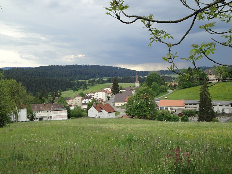
Photo: Wikimedia, CC BY-SA 3.0.
La Côte-aux-Fées is a municipality in the canton of Neuchâtel in Switzerland.
Les Verrières
Village

Photo: Wikimedia, CC BY-SA 3.0.
Les Verrières is a municipality in the canton of Neuchâtel in Switzerland. Les Verrières is situated 3 km northwest of Chez Antoine.
Les Bayards
Village

Photo: Roland Zumbuehl, CC BY 3.0.
Les Bayards was a municipality in the district of Val-de-Travers in the canton of Neuchâtel in Switzerland. On 1 January 2009, the former municipalities of Boveresse, Buttes, Couvet, Fleurier, Les Bayards, Môtiers, Noiraigue, Saint-Sulpice and Travers merged to form Val-de-Travers. Les Bayards is situated 4 km north of Chez Antoine.
Chez Antoine
- Type: House
- Categories: residential building and building
- Location: Val-de-Travers, Val-de-Travers District, Canton of Neuchâtel, Switzerland, Central Europe, Europe
- View on OpenStreetMap
Latitude
46.88255° or 46° 52′ 57″ northLongitude
6.49986° or 6° 29′ 60″ eastElevation
1,152 metres (3,780 feet)Open location code
8FR8VFMX+2WGeoNames ID
11546030
This page is based on GeoNames, Wikidata, and Wikimedia Commons.
We’d love your help improving our open data sources. Thank you for contributing.
Satellite Map
Discover Chez Antoine from above in high-definition satellite imagery.
In Other Languages
“Chez Antoine” goes by many names.
- French: “Chez Antoine”
Localities in the Area
Explore places such as Mont-de-Buttes and La Côte-aux-Fées.
Nearby Places
Explore places such as Chez Jean de Buttes and Mont-de-Buttes.
Switzerland: Must-Visit Destinations
Delve into Zurich, Berne, Geneva, and Basel.
Curious Places to Discover
Uncover intriguing places from every corner of the globe.
About Mapcarta. Text is available under the CC BY-SA 4.0 license, except for photos, directions, and the map. Photo: Spigaf, CC BY-SA 3.0.