Haselhof
Haselhof is a dwelling in Wiesendangen, Winterthur District, Canton of Zurich. Haselhof is situated nearby to the village Rickenbach, as well as near Bertschikon bei Attikon.| Tap on a place to explore it |
Places of Interest Nearby
Highlights include Kefikon Château and Rickenbach-Attikon railway station.
Kefikon Château
Castle
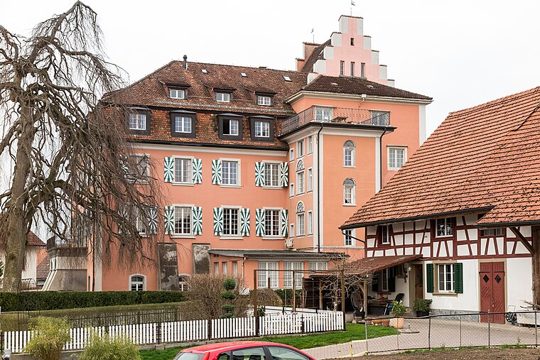
Photo: JoachimKohlerBremen, CC BY-SA 4.0.
Kefikon Château is a castle, which is situated 1½ km east of Haselhof.
Rickenbach-Attikon railway station
Railway station

Photo: JoachimKohlerBremen, CC BY-SA 4.0.
Rickenbach-Attikon is a railway station in the Swiss canton of Zurich and municipality of Rickenbach. It takes its name from that municipality, and the adjacent village of Attikon, in the municipality of Wiesendangen. Rickenbach-Attikon railway station is situated 2 km southwest of Haselhof.
Islikon railway station
Railway station

Photo: JoachimKohlerBremen, CC BY-SA 4.0.
Islikon railway station, or Gachnang-Islikon railway station, is a railway station in the Swiss canton of Thurgau and municipality of Gachnang. It takes its name from the adjacent village of Islikon. Islikon railway station is situated 2½ km east of Haselhof.
Places in the Area
Nearby places include Rickenbach and Bertschikon bei Attikon.
Rickenbach
Village

Photo: Fundriver, CC BY-SA 3.0.
Rickenbach is a municipality in the district of Winterthur in the canton of Zürich in Switzerland.
Bertschikon bei Attikon
Village

Photo: DidiWeidmann, CC BY-SA 3.0.
Bertschikon bei Attikon is a former municipality in the district of Winterthur in the canton of Zürich in Switzerland. On 1 January 2014 the former municipality of Bertschikon merged into the municipality of Wiesendangen.

Haselhof
- Type: Dwelling
- Categories: locality, residential building, and building
- Location: Wiesendangen, Winterthur District, Canton of Zurich, Switzerland, Central Europe, Europe
- View on OpenStreetMap
Latitude
47.54441° or 47° 32′ 40″ northLongitude
8.81083° or 8° 48′ 39″ eastElevation
446 metres (1,463 feet)Open location code
8FVCGRV6+Q8OpenStreetMap ID
node 2865236658OpenStreetMap feature
place=isolated_dwellingGeoNames ID
11731040
This page is based on OpenStreetMap, GeoNames, Wikidata, and Wikimedia Commons.
We’d love your help improving our open data sources. Thank you for contributing.
Satellite Map
Discover Haselhof from above in high-definition satellite imagery.
In Other Languages
“Haselhof” goes by many names.
- German: “Haselhof”
Places with the Same Name
Discover other places named “Haselhof”.
Localities in the Area
Explore places such as Tannholz and Menzengrüt.
Nearby Places
Explore places such as Neuhof and Mottli.
Switzerland: Must-Visit Destinations
Delve into Zurich, Berne, Geneva, and Basel.
Curious Places to Discover
Uncover intriguing places from every corner of the globe.
About Mapcarta. Data © OpenStreetMap contributors and available under the Open Database License". Text is available under the CC BY-SA 4.0 license, except for photos, directions, and the map. Photo: Roland zh, CC BY-SA 3.0.