Chumma
Chumma is a grove in Triesenberg, Liechtenstein and has an elevation of 882 metres. Chumma is situated nearby to the locality Fromahus, as well as near Raibühel.| Tap on a place to explore it |
Places of Interest
Highlights include Vaduz Cathedral and Liechtenstein National Museum.
Vaduz Cathedral
Church
 Vaduz Cathedral, or Cathedral of St. Florin, is a neo-Gothic church in Vaduz, Liechtenstein, and the centre of the Archdiocese of Vaduz. Originally a parish church, was elevated to the status of cathedral in 1997, and has held that designation since.
Liechtenstein National Museum
Museum
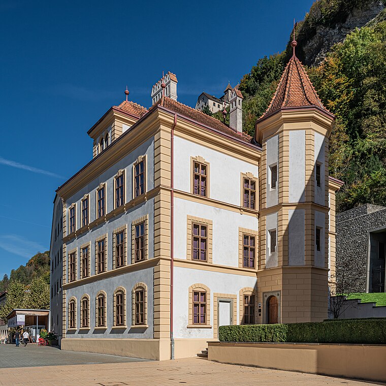 The Liechtenstein National Museum is a museum in Vaduz, the capital city of Liechtenstein.
Kunstmuseum Liechtenstein
Museum
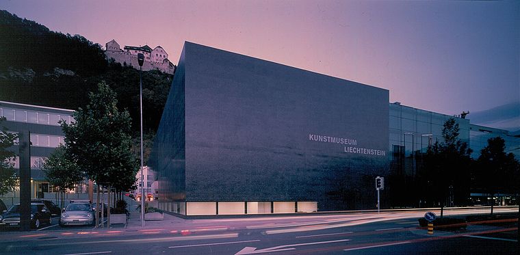
Photo: Wikimedia, CC BY-SA 3.0.
The Kunstmuseum Liechtenstein is a state art museum in Vaduz, Liechtenstein. The building by the Swiss architects Meinrad Morger, Heinrich Degelo and Christian Kerez was completed in November 2000.
Places in the Area
Nearby places include Masescha and Rotenboden.
Masescha
Village
 Masescha is a Weiler of Liechtenstein, located in the municipality of Triesenberg. It is situated at approximately 1,230 metres above sea level on a glacial moraine plain.
Rotenboden
Village
Rotenboden is a Weiler of Liechtenstein, located in the municipality of Triesenberg. It is the highest settlement in Liechtenstein at 850m elevation.
Vaduz

Photo: Wikimedia, CC BY-SA 2.5.
Vaduz is the capital city of Liechtenstein and has a population of 5,700. It's home to the prince's castle and his museums, and thus the main point of interest for visitors to this small country.
Chumma
- Type: Grove
- Location: Triesenberg, Liechtenstein, Central Europe, Europe
- View on OpenStreetMap
Latitude
47.13421° or 47° 8′ 3″ northLongitude
9.53365° or 9° 32′ 1″ eastElevation
882 metres (2,894 feet)Open location code
8FVF4GMM+MFGeoNames ID
11750325
This page is based on GeoNames, Wikidata, and Wikimedia Commons.
We’d love your help improving our open data sources. Thank you for contributing.
Satellite Map
Discover Chumma from above in high-definition satellite imagery.
Places with the Same Name
Discover other places named “Chumma”.
Localities in the Area
Explore places such as Fromahus and Raibühel.
Notable Places Nearby
Highlights include Stellböda and Rotabodnerwald.
Curious Groves to Discover
Uncover intriguing groves from every corner of the globe.
About Mapcarta. Text is available under the CC BY-SA 4.0 license, except for photos, directions, and the map. Photo: Wikimedia, CC BY 3.0.