Sennhütte
Sennhütte is a dwelling in Winterthur, Canton of Zurich. Sennhütte is situated nearby to the village Iberg, as well as near Gotzenwil.| Tap on a place to explore it |
Places of Interest Nearby
Highlights include St. Antonius and Sennhof-Kyburg railway station.
St. Antonius
Church
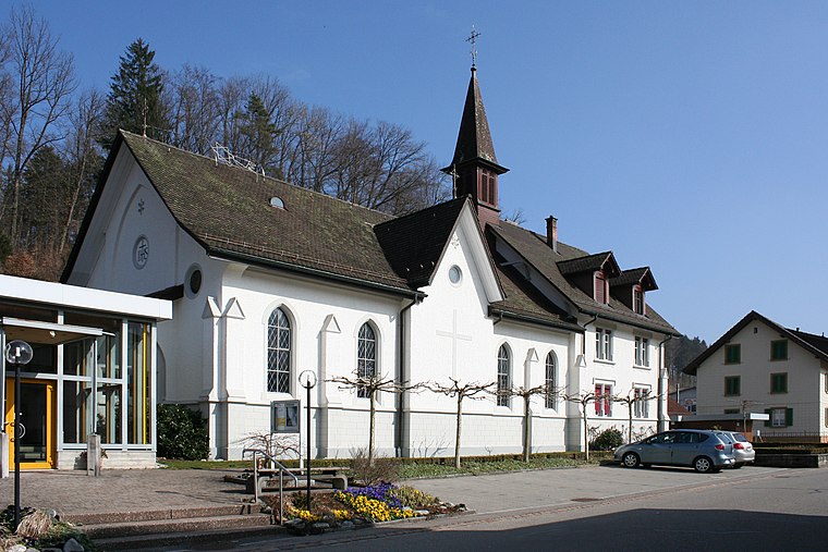
Photo: Charly Bernasconi, CC BY-SA 3.0.
St. Antonius is a church, which is situated 1¼ km south of Sennhütte.
Sennhof-Kyburg railway station
Railway stop

Photo: Wikimedia, CC BY-SA 4.0.
Sennhof-Kyburg railway station is a railway station in the city of Winterthur in the canton of Zurich, Switzerland. It takes its name from the city's quarter of Sennhof, in which it is located, together with the adjoining municipality of Kyburg. Sennhof-Kyburg railway station is situated 1¼ km west of Sennhütte.
Kollbrunn railway station
Railway stop

Photo: Roland zh, CC BY-SA 3.0.
Kollbrunn railway station is a railway station in the Swiss canton of Zürich. The station is situated in the village of Kollbrunn within the municipality of Zell. Kollbrunn railway station is situated 1 km south of Sennhütte.
Places in the Area
Nearby places include Iberg and Gotzenwil.
Iberg
Village
Iberg is a quarter in district 3 of Winterthur. It was formerly a part of the Seen municipality, which was incorporated into Winterthur in 1922.
Gotzenwil
Village
Gotzenwil is a quarter in the district 3 of Winterthur. It was formerly a part of Seen municipality, which was incorporated into Winterthur in 1922.
Kollbrunn
Village

Photo: Roland zh, CC BY-SA 3.0.
Kollbrunn is a village within the municipality of Zell in the canton of Zurich in Switzerland.
Sennhütte
- Type: Dwelling
- Also known as: “Sennhuette”
- Categories: locality, residential building, and building
- Location: Winterthur, Winterthur District, Canton of Zurich, Zurich, Switzerland, Central Europe, Europe
- View on OpenStreetMap
Latitude
47.46829° or 47° 28′ 6″ northLongitude
8.77596° or 8° 46′ 33″ eastElevation
541 metres (1,775 feet)Open location code
8FVCFQ9G+89OpenStreetMap ID
node 1079105214OpenStreetMap feature
place=isolated_dwellingGeoNames ID
11763692
This page is based on OpenStreetMap, GeoNames, Wikidata, and Wikimedia Commons.
We’d love your help improving our open data sources. Thank you for contributing.
Satellite Map
Discover Sennhütte from above in high-definition satellite imagery.
In Other Languages
“Sennhütte” goes by many names.
- German: “Sennhütte”
Places with the Same Name
Discover other places named “Sennhütte”.
Localities in the Area
Explore places such as Seen (Kreis 3) / Weier and Seen (Kreis 3) / Weierhöhe.
Nearby Places
Explore places such as Milchtankstelle and Schulhaus Weierweid.
Zurich: Must-Visit Destinations
Delve into Zurich, Aarau, Zug, and Zurich Airport.
Curious Houses to Discover
Uncover intriguing houses from every corner of the globe.
About Mapcarta. Data © OpenStreetMap contributors and available under the Open Database License". Text is available under the CC BY-SA 4.0 license, except for photos, directions, and the map. Photo: Wikimedia, CC0.