[Cheb-Háje] GSM
[Cheb-Háje] GSM is a tower in Cheb, Karlovy Vary Region. [Cheb-Háje] GSM is situated nearby to the hamlet Svatý Kříž, as well as near the memorial Památník obětem železné opony.| Tap on a place to explore it |
Places of Interest Nearby
Highlights include Památník obětem železné opony and Cheb - klášter Milosrdných sester svatého Kříže.
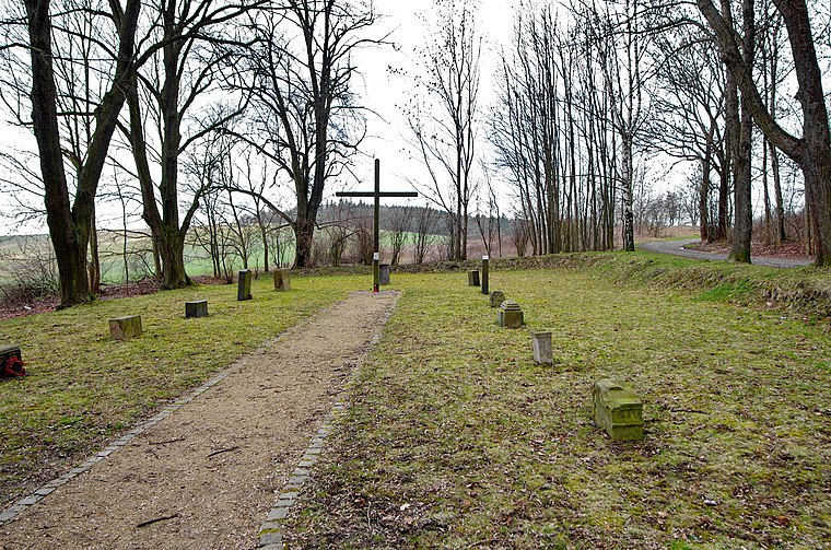
Památník obětem železné opony
Memorial

Photo: Lubor Ferenc, CC BY-SA 4.0.
Památník obětem železné opony is a memorial, which is situated 410 metres southwest of [Cheb-Háje] GSM.
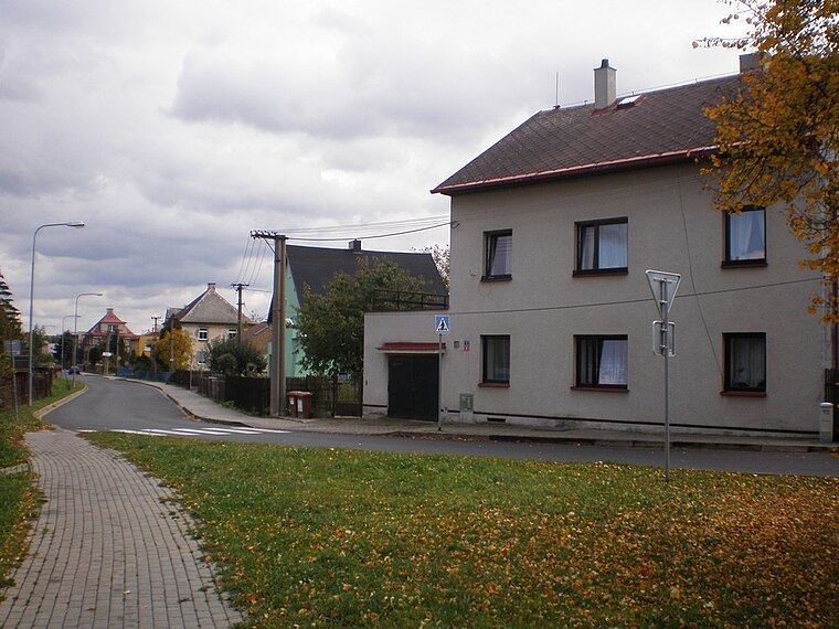
Cheb - klášter Milosrdných sester svatého Kříže

Photo: MartinVeselka, CC BY-SA 4.0.
Cheb - klášter Milosrdných sester svatého Kříže is situated 2½ km north of [Cheb-Háje] GSM.
Cheb railway station
Railway station

Photo: Lubor Ferenc, CC BY-SA 4.0.
Cheb railway station is a railway station in the city of Cheb in the Karlovy Vary Region in the western part of the Czech Republic. Cheb railway station is situated 4 km northeast of [Cheb-Háje] GSM.
Places in the Area
Nearby places include Svatý Kříž and Pelhřimov.

[Cheb-Háje] GSM
- Type: Tower
- Also known as: “[Cheb-Haje] GSM”
- Location: Cheb, Cheb District, Karlovy Vary Region, West Bohemia, Czech Republic, Central Europe, Europe
- View on OpenStreetMap
Latitude
50.04622° or 50° 2′ 46″ northLongitude
12.34898° or 12° 20′ 56″ eastElevation
541 metres (1,775 feet)Open location code
9F2J28WX+FHGeoNames ID
12059821
This page is based on GeoNames, Wikidata, and Wikimedia Commons.
We’d love your help improving our open data sources. Thank you for contributing.
Satellite Map
Discover [Cheb-Háje] GSM from above in high-definition satellite imagery.
Localities in the Area
Explore places such as Wies and Krásná Lípa.
Nearby Places
Explore places such as [Cheb-Háje] HG and Hundsbach.
West Bohemia: Must-Visit Destinations
Delve into Pilsen, Karlovy Vary, Mariánské Lázně, and Aš.
Curious Towers to Discover
Uncover intriguing towers from every corner of the globe.
About Mapcarta. Text is available under the CC BY-SA 4.0 license, except for photos, directions, and the map. Photo: Karelj, CC BY-SA 3.0.