Buchberg
Buchberg is a hill in Kulmbach, Upper Franconia, Bavaria and has an elevation of 471 metres. Buchberg is situated nearby to the village Kauernburg, as well as near Unterpurbach.| Tap on a place to explore it |
Places of Interest
Highlights include Plassenburg and Rathaus.
Plassenburg
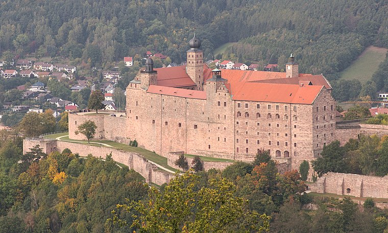
Photo: El Grafo, CC BY-SA 4.0.
Plassenburg is a castle in the city of Kulmbach in Bavaria. It is one of the most impressive castles in Germany and a symbol of the city. It was first mentioned in 1135.


Places in the Area
Nearby places include Ziegelhütten (Kulmbach) and Mangersreuth.
Ziegelhütten (Kulmbach)
Village
 Ziegelhütten (Kulmbach) is a village, which is situated 2½ km northwest of Buchberg.
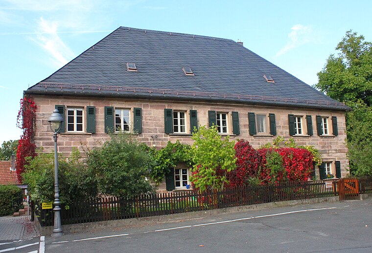
Petzmannsberg
Hamlet

Photo: Holy-DYVR, CC BY-SA 4.0.
Petzmannsberg is a hamlet, which is situated 3 km west of Buchberg.
Buchberg
- Type: Hill with an elevation of 471 metres
- Category: landform
- Location: Kulmbach, Kulmbach, Upper Franconia, Franconia, Bavaria, Germany, Central Europe, Europe
- View on OpenStreetMap
Latitude
50.106° or 50° 6′ 22″ northLongitude
11.4791° or 11° 28′ 45″ eastElevation
471 metres (1,545 feet)Open location code
9F2H4F4H+9JGeoNames ID
12070436
This page is based on GeoNames, Wikidata, and Wikimedia Commons.
We’d love your help improving our open data sources. Thank you for contributing.
Satellite Map
Discover Buchberg from above in high-definition satellite imagery.
Places with the Same Name
Discover other places named “Buchberg”.
Localities in the Area
Explore places such as Kauernburg and Unterpurbach.
Notable Places Nearby
Highlights include Rehberg and Deutsches Zinnfigurenmuseum.
Upper Franconia: Must-Visit Destinations
Delve into Bamberg, Bayreuth, Coburg, and Hof.
Curious Places to Discover
Uncover intriguing places from every corner of the globe.
About Mapcarta. Text is available under the CC BY-SA 4.0 license, except for photos, directions, and the map. Photo: Wikimedia, CC0.