Rue Saint-Paul
Rue Saint-Paul is a street in Lyon, Greater Lyon, Auvergne-Rhône-Alpes. Rue Saint-Paul is situated nearby to the church Église Saint-Paul de Lyon, as well as near the railway station Lyon-Saint-Paul station.| Tap on a place to explore it |
Places of Interest Nearby
Highlights include Lyon-Saint-Paul station and Église Saint-Paul de Lyon.
Lyon-Saint-Paul station
Railway station

Photo: Remontees, CC BY-SA 4.0.
Lyon-Saint-Paul is a railway station in the 5th arrondissement of Lyon, France. It is located in the area of the same name at the northern end of the Vieux Lyon quarter, between the base of the Fourvière hill and the river Saône.
Église Saint-Paul de Lyon
Church

Photo: Samari Prismade, CC BY-SA 4.0.
The Église Saint-Paul is a Roman Catholic church located in Lyon, France. It is situated in the Vieux Lyon, in the Saint-Paul quarter, in the 5th arrondissement of Lyon.
Museum of Fine Arts of Lyon
Museum
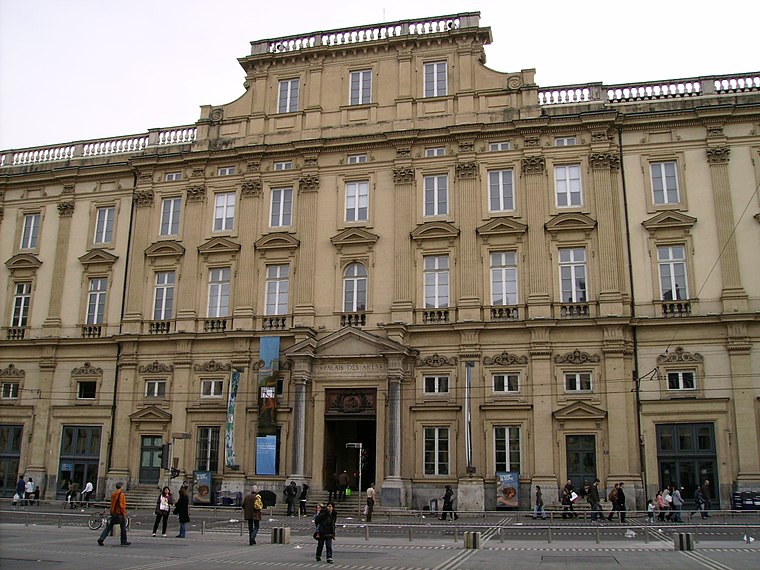
Photo: Alorange, Public domain.
The Museum of Fine Arts of Lyon is a municipal museum of fine arts in the French city of Lyon. Located near the Place des Terreaux, it is housed in a former Benedictine convent which was active during the 17th and 18th centuries. Museum of Fine Arts of Lyon is situated 560 metres east of Rue Saint-Paul.
Places in the Area
Nearby places include Saint-Paul and 1st arrondissement of Lyon.
Saint-Paul
Neighborhood

Photo: Gonedelyon, CC BY-SA 3.0.
Saint-Paul is a quarter located in the 5th arrondissement of Lyon, France. It was named after the parish church. Located in the perimeter saved registered to the UNESCO World Heritage Site, it is one of the three parishes of the Vieux Lyon, the historic center of the city.
1st arrondissement of Lyon
Suburb
 The 1st arrondissement of Lyon is one of the nine arrondissements of the City of Lyon. It is located below the hill of Croix-Rousse and on the north part of the Presqu'île formed by the Saône and the Rhône, the two rivers in Lyon.
Vieux Lyon
Suburb
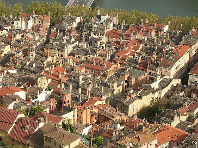
Photo: Karldupart, CC BY-SA 3.0.
Vieux Lyon is the largest Renaissance district of Lyon. In 1964, Vieux-Lyon, the city's oldest district, became the first site in France to be protected under the Malraux law to protect France's cultural sites.
Rue Saint-Paul
- Type: Street
- Category: transportation
- Location: Lyon, Arrondissement of Lyon, Greater Lyon, Auvergne-Rhône-Alpes, France, Europe
- View on OpenStreetMap
Latitude
45.7667° or 45° 46′ 0″ northLongitude
4.82637° or 4° 49′ 35″ eastElevation
173 metres (568 feet)Open location code
8FQ6QR8G+MGGeoNames ID
12574113
This page is based on GeoNames, Wikidata, and Wikimedia Commons.
We’d love your help improving our open data sources. Thank you for contributing.
Satellite Map
Discover Rue Saint-Paul from above in high-definition satellite imagery.
Places with the Same Name
Discover other places named “Rue Saint-Paul”.
Localities in the Area
Explore places such as Ouest des Pentes and Quartiers Anciens.
Nearby Places
Explore places such as Montée des Carmes Déchaussés and Rue Docteur Augros.
Greater Lyon: Must-Visit Destinations
Delve into Saint-Étienne, Roanne, Villefranche-sur-Saône, and Divonne-les-Bains.
Curious Streets to Discover
Uncover intriguing streets from every corner of the globe.
About Mapcarta. Text is available under the CC BY-SA 4.0 license, except for photos, directions, and the map. Photo: Fabimaru, CC0.