Merrimack Valley
Merrimack Valley is a region northwest of Boston in Massachusetts. It consists of several towns in Middlesex and Essex Counties.| Tap on a place to explore it |
Essential Destinations
Top destinations include Lowell and Lawrence.
Lowell

Photo: Emw, CC BY-SA 3.0.
Lowell is a city in Massachusetts about 40 minutes northwest of Boston. With over 115,000 residents, it's the fifth largest city in Massachusetts, and has an important historical background. It was the first planned industrial city in the United States.
Lawrence
 Lawrence is a city in Massachusetts with a population of about 89,000. Methuen is a city in Massachusetts with a population of 53,000.
Haverhill
 Haverhill is a city in Essex County, Massachusetts, United States. Haverhill is located 35 miles north of Boston on the New Hampshire border and about 17 miles from the Atlantic Ocean.
Destinations to Discover
Explore places such as Amesbury and Andover.
Amesbury

Photo: Wikimedia, CC BY-SA 3.0.
Amesbury is a town in Massachusetts with a population of 17,000. Merrimac is a town with a population of 7,000.
Andover
 Andover is a town in Massachusetts with a population of 37,000. It is situated at the crossroads of I-495 and I-93 in the heart of the Merrimack Valley.
Groton

Photo: Pvmoutside, CC BY-SA 3.0.
Groton is a town of about 10,500 people in Middlesex County, in the Merrimack Valley region of Massachusetts. Groton, like a lot of towns in New England, has a plethora of historic homes and structures to see.
Wilmington
 Wilmington is a city of around 23,000 people in the Merrimack Valley region. Tewksbury is a town in Massachusetts with a population of 31,000.
Townsend

Photo: Marcbela, Public domain.
Townsend is a town in Massachusetts with a population of 9,000. Ashby is a town in Massachusetts with a population of 3,000.
Billerica
 Billerica is a city of 42,000 people in Massachusetts that is on the border between Boston’s inner suburbs to the south and the Merrimack Valley region to the north.
North Reading
 North Reading is a town of 15,000 in the southern part of the Merrimack Valley region of Eastern Massachusetts. Middleton is a town with a population of 10,000.
Shirley

Photo: Bob Burkhardt, CC BY 3.0.
Shirley is a city in Merrimack Valley with a population of 7,000. The town was named for former Governor William Shirley, and was settled in 1720 and incorporated in 1775.
Groveland
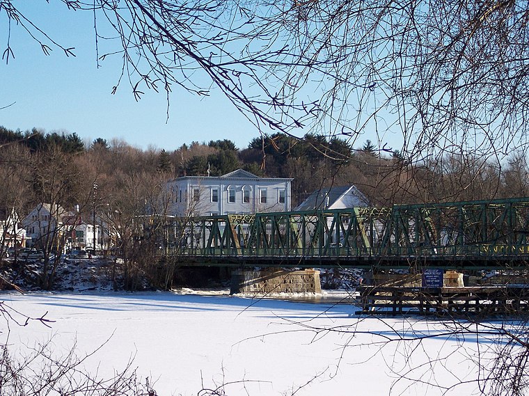
Photo: LymanSchool, CC BY-SA 3.0.
Groveland is a town in Merrimack Valley with a population of 7,000. Georgetown is a town of 8,000. West Newbury is a small town of 4,500. Boxford is a town of about 8,000.
Westford
 Westford is a city in the Merrimack Valley of Massachusetts. With a population of roughly 25,000, it's a thriving outer suburb of Lowell, with high tech industries.
Tyngsborough

Photo: Faolin42, CC BY-SA 4.0.
Tyngsborough is a town in Massachusetts with a population of 12,000. Dracut is a town with a population of 33,00. Dunstable is a town with a population of 3,000.
Merrimack Valley
- Type: region
- Description: region of Massachusetts
- Location: Eastern Massachusetts, Massachusetts, New England, United States, North America
- View on OpenStreetMap
Latitude of center
42.724° or 42° 43′ 26″ northLongitude of center
-71.108° or 71° 6′ 29″ westWikidata ID
Q14842834
This page is based on Wikidata, Wikimedia Commons, and Wikivoyage.
We’d love your help improving our open data sources. Thank you for contributing.
Satellite Map
Discover Merrimack Valley from above in high-definition satellite imagery.
In Other Languages
From Japanese to Persian—“Merrimack Valley” goes by many names.
- Japanese: “メリマック・ヴァリー”
- Persian: “شهرستان میدلسکس”
Eastern Massachusetts: Must-Visit Destinations
Delve into Boston, Cambridge, Downtown Boston, and Back Bay-Beacon Hill.
Explore These Curated Destinations
Discover places selected for their distinct character and enduring appeal.
About Mapcarta. Text is available under the CC BY-SA 4.0 license, except for photos, directions, and the map. Description text is based on the Wikivoyage page “Merrimack Valley”. Photo: Wikimedia, CC0.