Pont de la forge
Pont de la forge is in Chamonix, Arrondissement of Bonneville, Auvergne-Rhône-Alpes and has an elevation of 1,084 metres. Pont de la forge is situated nearby to the railway station Les Tines station, as well as near the climbing site La Forêt Magique.| Tap on a place to explore it |
Places of Interest Nearby
Highlights include Les Praz-de-Chamonix station and Chamonix-Mont-Blanc station.
Les Praz-de-Chamonix station
Railway station

Photo: Pucesurvitaminee, CC BY-SA 3.0.
Les Praz-de-Chamonix station is a railway station in the commune of Chamonix-Mont-Blanc, in the French department of Haute-Savoie. It is located on the 1,000 mm gauge Saint-Gervais–Vallorcine line of SNCF. Les Praz-de-Chamonix station is situated 1½ km south of Pont de la forge.
Chamonix-Mont-Blanc station
Railway station
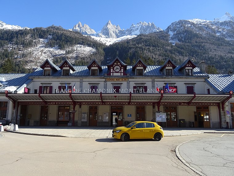
Photo: Remontees, CC BY-SA 4.0.
Chamonix-Mont-Blanc station is a railway station in the commune of Chamonix-Mont-Blanc, in the French department of Haute-Savoie. It is located on the 1,000 mm gauge Saint-Gervais–Vallorcine line of SNCF. Chamonix-Mont-Blanc station is situated 3½ km southwest of Pont de la forge.
La Flégère
Mountain hut

Photo: Nicolas Vigier, CC BY 2.0.
La Flégère is a mountain hut, which is situated 1 km northwest of Pont de la forge.
Places in the Area
Nearby places include Les Praz and Argentière.
Les Praz
Hamlet

Photo: Kulmalukko, CC BY-SA 3.0.
Les-Praz-de-Chamonix is a mountain village in the French Alps, part of the commune of Chamonix. Altitude: 1060 m.
Argentière
Village

Photo: Kulmalukko, CC BY-SA 3.0.
Argentière is a picturesque skiing, alpine walking and mountaineering village in the French Alps, part of the commune of Chamonix-Mont-Blanc, at an altitude of 1,252 m. Argentière is situated 4½ km northeast of Pont de la forge.
Montroc
Hamlet

Photo: X-Weinzar, CC BY-SA 3.0.
Montroc is a hamlet in eastern France, located in the territory of the commune of Chamonix. Several houses at Poses 150 m north-east of Montroc were destroyed on 9 February 1999 by a slab avalanche from Bec du Lachat and Mont Peclerey on the Mont Blanc massif, killing 12 people. Montroc is situated 6 km northeast of Pont de la forge.
Pont de la forge
- Type: Sign
- Categories: information and tourism
- Location: Chamonix, Arrondissement of Bonneville, Haute-Savoie, Auvergne-Rhône-Alpes, France, Europe
- View on OpenStreetMap
Latitude
45.95224° or 45° 57′ 8″ northLongitude
6.89628° or 6° 53′ 47″ eastElevation
1,084 metres (3,556 feet)Open location code
8FQ8XV2W+VGOpenStreetMap ID
node 10009113525OpenStreetMap feature
tourism=information
This page is based on OpenStreetMap, Wikidata, and Wikimedia Commons.
We’d love your help improving our open data sources. Thank you for contributing.
Satellite Map
Discover Pont de la forge from above in high-definition satellite imagery.
Places with the Same Name
Discover other places named “Pont de la forge”.
Notable Places Nearby
Highlights include Les Tines station and La Forêt Magique.
Nearby Places
Explore places such as Les Tines and Résidence Odalys Isatis.
Haute-Savoie: Must-Visit Destinations
Delve into Annecy, Annemasse, Evian, and Megève.
Curious Places to Discover
Uncover intriguing places from every corner of the globe.
About Mapcarta. Data © OpenStreetMap contributors and available under the Open Database License". Text is available under the CC BY-SA 4.0 license, except for photos, directions, and the map. Photo: Ximonic, CC BY 2.5.