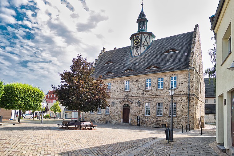
SKS #26 Salzlandmuseum
SKS #26 Salzlandmuseum is in Schönebeck (Elbe), Salzlandkreis, Saxony-Anhalt. SKS #26 Salzlandmuseum is situated nearby to Pfännerstraße, as well as near the church Adventsgemeinde.| Tap on a place to explore it |
Places of Interest Nearby
Highlights include Salzlandmuseum and St. Johannis (Schönebeck).
St. Johannis (Schönebeck)
Church
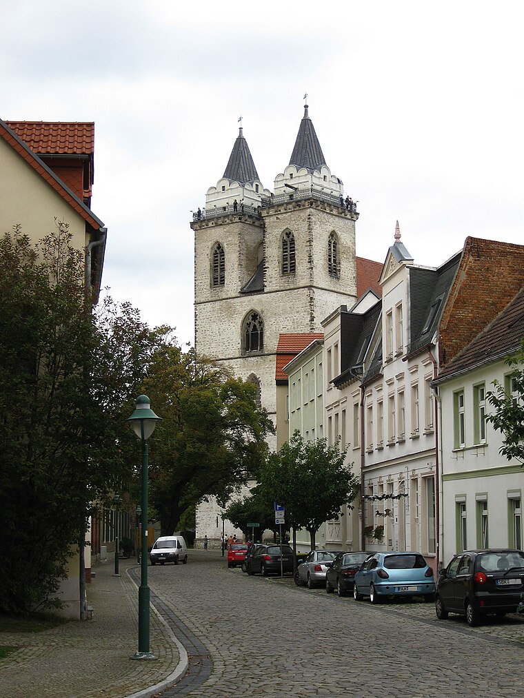 St. Johannis (Schönebeck) is a church, which is situated 190 metres southwest of SKS #26 Salzlandmuseum.
Burg Schadeleben
Castle

Photo: Jackiman, CC BY-SA 3.0.
Burg Schadeleben is a castle, which is situated 260 metres northeast of SKS #26 Salzlandmuseum.
Places in the Area
Nearby places include Bad Salzelmen and Schönebeck.
Bad Salzelmen
Suburb
Bad Salzelmen has been a district of Schönebeck since 1932 and is a state-approved spa in the Salzlandkreis in Saxony-Anhalt, Germany. It was founded in 1894 when the town of Groß Salze absorbed the neighbouring town of Elmen.
Schönebeck
Town
 Schönebeck, officially Schönebeck, is a town in the district of Salzlandkreis, in Saxony-Anhalt, Germany. It is situated on the left bank of the Elbe, approx.
Biere
Village

Photo: Wolkenkratzer, CC BY-SA 4.0.
Biere is a former municipality in the district of Salzlandkreis, in Saxony-Anhalt, Germany. Since January 2008, it is part of the municipality Bördeland. Biere is situated 6 km southwest of SKS #26 Salzlandmuseum.
SKS #26 Salzlandmuseum
- Type: Tourism
- Category: tourist attraction
- Location: Schönebeck (Elbe), Salzlandkreis, Saxony-Anhalt, Germany, Central Europe, Europe
- View on OpenStreetMap
Latitude
52.00484° or 52° 0′ 17″ northLongitude
11.72451° or 11° 43′ 28″ eastOperator
Salzländer Kulturstempel e. V.Open location code
9F4H2P3F+WROpenStreetMap ID
node 10036736941OpenStreetMap feature
tourism=yes
This page is based on OpenStreetMap, Wikidata, and Wikimedia Commons.
We’d love your help improving our open data sources. Thank you for contributing.
Satellite Map
Discover SKS #26 Salzlandmuseum from above in high-definition satellite imagery.
Notable Places Nearby
Highlights include Pfännerstraße and Adventsgemeinde.
Nearby Places
Explore places such as Salzlandsparkasse and Lotto Toto.
Saxony-Anhalt: Must-Visit Destinations
Delve into Magdeburg, Halle, Wittenberg, and Quedlinburg.
Curious Places to Discover
Uncover intriguing places from every corner of the globe.
About Mapcarta. Data © OpenStreetMap contributors and available under the Open Database License". Text is available under the CC BY-SA 4.0 license, except for photos, directions, and the map. Photo: GMM, Public domain.