Tøjseksperten
Tøjseksperten is a clothing store in Odense Municipality, Region of Southern Denmark. Tøjseksperten is situated nearby to the health club PureGym, as well as near the recreation area Creative Space Odense.| Tap on a place to explore it |
Places of Interest Nearby
Highlights include Kunstmuseum Brandts and Saint Canute’s Cathedral.
Kunstmuseum Brandts
Arts center

Photo: Wikimedia, CC BY-SA 2.0 de.
Kunstmuseum Brandts is an arts center.
Saint Canute’s Cathedral
Church
 St. Canute's Cathedral, also known as Odense Cathedral, is named after the Danish king Canute the Saint, otherwise Canute IV. It is a fine example of Brick Gothic architecture. Saint Canute’s Cathedral is situated 440 metres east of Tøjseksperten.
Odense Teater
Theater building
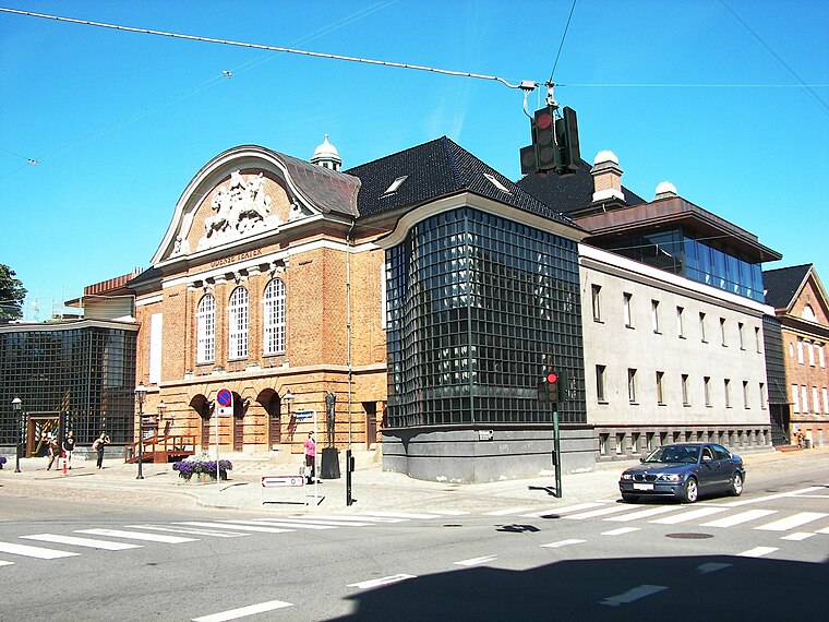
Photo: Sendelbach, CC BY-SA 3.0.
Odense Teater is a theater in the city of Odense in Denmark. It dates back to 1796, which makes it Denmark's second-oldest theater. It is one of the country's three main theaters. Odense Teater is situated 320 metres northeast of Tøjseksperten.
Places in the Area
Nearby places include Odense and Hunderup.
Odense
 Odense is the largest city on the island of Funen in Denmark. As Denmark's third-largest city, it offers the traveller a mixture of an exciting vibrant night-life, beautiful street-scapes, great shopping opportunities & a rich cultural heritage.
Næsby
Suburb
Næsby is a western central neighbourhood of Odense, in Funen, Denmark. Næsby is situated 2½ km northwest of Tøjseksperten.
Tøjseksperten
- Type: Clothing store
- Category: shop
- Location: Odense Municipality, Region of Southern Denmark, Denmark, Nordic countries, Europe
- View on OpenStreetMap
Latitude
55.39628° or 55° 23′ 47″ northLongitude
10.38214° or 10° 22′ 56″ eastOpen location code
9F7G99WJ+GVOpenStreetMap ID
node 10100560094OpenStreetMap feature
shop=clothes
This page is based on OpenStreetMap, Wikidata, and Wikimedia Commons.
We’d love your help improving our open data sources. Thank you for contributing.
Satellite Map
Discover Tøjseksperten from above in high-definition satellite imagery.
Notable Places Nearby
Highlights include PureGym and Creative Space Odense.
Nearby Places
Explore places such as The woman with the eggs and In Nomine Panis.
Denmark: Must-Visit Destinations
Delve into Copenhagen, Aarhus, Odense, and Aalborg.
Curious Clothing Stores to Discover
Uncover intriguing clothing stores from every corner of the globe.
About Mapcarta. Data © OpenStreetMap contributors and available under the Open Database License". Text is available under the CC BY-SA 4.0 license, except for photos, directions, and the map. Photo: Wikimedia, CC0.