Carl Albert Edelfeltin aukio
Carl Albert Edelfeltin aukio is a square in Vantaa, Helsinki sub-region, Uusimaa. Carl Albert Edelfeltin aukio is situated nearby to Tikkurila Old railway station, as well as near Vantaa City Museum.| Tap on a place to explore it |
Places of Interest Nearby
Highlights include Tikkurila Old railway station and Vantaa City Museum.


Helsinki Tikkurila Railway Station
Railway station
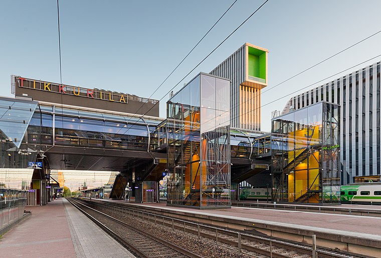 Tikkurila station is located in Tikkurila, the administrative centre of Vantaa in the Helsinki metropolitan area. It is located approximately 16 kilometres from Helsinki Central railway station and 5 kilometres from Helsinki Airport. Helsinki Tikkurila Railway Station is situated 200 metres northeast of Carl Albert Edelfeltin aukio.
Places in the Area
Nearby places include Tikkurila and Jokiniemi.
Tikkurila
Suburb
 Vantaa is in the Uusimaa region in southern Finland, right north of Helsinki. Part of the Helsinki Metropolitan Area, it is the fourth most populous city in Finland with about 240,000 inhabitants as of 2021.

Hiekkaharju
Suburb
Hiekkaharju is a district in Vantaa, Finland, located north of the Tikkurila district. It has its own railway station, the Hiekkaharju railway station, which serves commuter trains around Greater Helsinki.
Carl Albert Edelfeltin aukio
- Type: Square
- Category: locality
- Location: Vantaa, Helsinki sub-region, Uusimaa, Southern Finland, Finland, Nordic countries, Europe
- View on OpenStreetMap
Latitude
60.29122° or 60° 17′ 28″ northLongitude
25.04258° or 25° 2′ 33″ eastOpen location code
9GG772RV+F2OpenStreetMap ID
node 10101685896OpenStreetMap feature
place=square
This page is based on OpenStreetMap, Wikidata, and Wikimedia Commons.
We’d love your help improving our open data sources. Thank you for contributing.
Satellite Map
Discover Carl Albert Edelfeltin aukio from above in high-definition satellite imagery.
In Other Languages
From Finnish to Swedish—“Carl Albert Edelfeltin aukio” goes by many names.
- Finnish: “Carl Albert Edelfeltin aukio”
- Swedish: “Carl Albert Edelfelts plats”
Notable Places Nearby
Highlights include Tulisuudelma and Tikkurilan Veteraanipuisto.
Nearby Places
Explore places such as Koseli and Akvaario Kurki Oy.
Uusimaa: Must-Visit Destinations
Delve into Helsinki, Espoo, Porvoo, and Lohja.
Curious Squares to Discover
Uncover intriguing squares from every corner of the globe.
About Mapcarta. Data © OpenStreetMap contributors and available under the Open Database License". Text is available under the CC BY-SA 4.0 license, except for photos, directions, and the map. Photo: Wikimedia, CC0.