Iglesia de San Pedro y San Francisco Javier
Iglesia de San Pedro y San Francisco Javier is a church in Algeciras, Cádiz, Andalusia. Iglesia de San Pedro y San Francisco Javier is situated nearby to the pitch Campo de Futbol Elcano, as well as near the archaeological site Restos de Murallas.| Tap on a place to explore it |
Places of Interest Nearby
Highlights include Parque de las Acacias de Algeciras and Algeciras Railway Station.
Parque de las Acacias de Algeciras
Park

Photo: Falconaumanni, CC BY-SA 3.0.
Parque de las Acacias de Algeciras is a park in Algeciras, southeastern Spain. Established in 1975, it covers an area of 19,300 square metres. The Museo municipal de Algeciras lies to the north and Villa Smith lies in the southern part of the park.
Algeciras Railway Station
Railway station

Photo: Falconaumanni, CC BY-SA 4.0.
Algeciras railway station is the southernmost rail station on the Spanish rail network and on the European mainland, and serves the town of Algeciras, Andalusia. Algeciras Railway Station is situated 1 km northwest of Iglesia de San Pedro y San Francisco Javier.
Roman fish salting factory
Archaeological site

Photo: Falconaumanni, CC BY-SA 3.0.
The Roman fish salting factory was a salting factory established on the seafront of Algeciras, southeastern Spain by the Romans. It belonged to the fishing village of San Nicolás, part of what was called Caetaria. Roman fish salting factory is situated 620 metres north of Iglesia de San Pedro y San Francisco Javier.
Places in the Area
Nearby places include Palmones and El Pelayo.
Palmones
Village
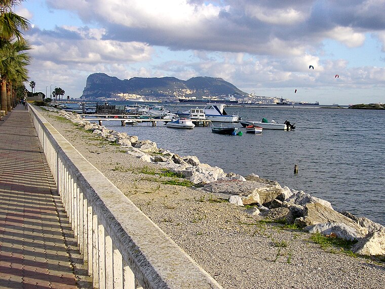
Photo: Falconaumanni, CC BY-SA 4.0.
Palmones is a village on the Bay of Gibraltar between Algeciras and La Linea de la Concepcion in the Province of Cádiz in Spain. The San Roque Refinery and Los Barrios commercial centre lie on either side of the town. Palmones is situated 6 km north of Iglesia de San Pedro y San Francisco Javier.
El Pelayo
Hamlet
El Pelayo or Pelayo is a village in the municipality of Algeciras in the Province of Cadiz in southeastern Spain, It is located 7 miles southwest from the city centre, along the main road to the southern tip of Spain at Tarifa, which is 14 kilometres away. El Pelayo is situated 6 km southwest of Iglesia de San Pedro y San Francisco Javier.
Los Cortijillos
Village

Photo: El Pantera, CC BY-SA 4.0.
Los Cortijillos is a village and district of the Spanish municipality of Los Barrios of the Province of Cádiz, Andalucia, Spain. It is located six kilometres east of the main town of the municipality, just south of Guadacorte, between Gibraltar and Algeciras. Los Cortijillos is situated 8 km north of Iglesia de San Pedro y San Francisco Javier.
Iglesia de San Pedro y San Francisco Javier
Latitude
36.12002° or 36° 7′ 12″ northLongitude
-5.44617° or 5° 26′ 46″ westOpen location code
8C8P4HC3+2GOpenStreetMap ID
node 10102014792OpenStreetMap feature
amenity=place_of_worshipOpenStreetMap feature
building=church
This page is based on OpenStreetMap, Wikidata, and Wikimedia Commons.
We’d love your help improving our open data sources. Thank you for contributing.
Satellite Map
Discover Iglesia de San Pedro y San Francisco Javier from above in high-definition satellite imagery.
Notable Places Nearby
Highlights include Campo de Futbol Elcano and Restos de Murallas.
Nearby Places
Explore places such as General Marina - Iglesia and Victoria Eugenia - Pescadores.
Cádiz: Must-Visit Destinations
Delve into Cádiz, Jerez de la Frontera, Tarifa, and El Puerto de Santa María.
Curious Churches to Discover
Uncover intriguing churches from every corner of the globe.
About Mapcarta. Data © OpenStreetMap contributors and available under the Open Database License". Text is available under the CC BY-SA 4.0 license, except for photos, directions, and the map. Photo: Falconaumanni, CC BY 3.0.