Direction de la Communication
Direction de la Communication is a government office in Arras, Pas-de-Calais, Hauts-de-France. Direction de la Communication is situated nearby to the government office Maison Départementale de l’Aménagement et du Développement Territorial de l’Arrageois, as well as near the library Bibliothèque Robinson.| Tap on a place to explore it |
Places of Interest Nearby
Highlights include Arras station and Wellington Quarry Museum WW1.
Arras station
Railway station
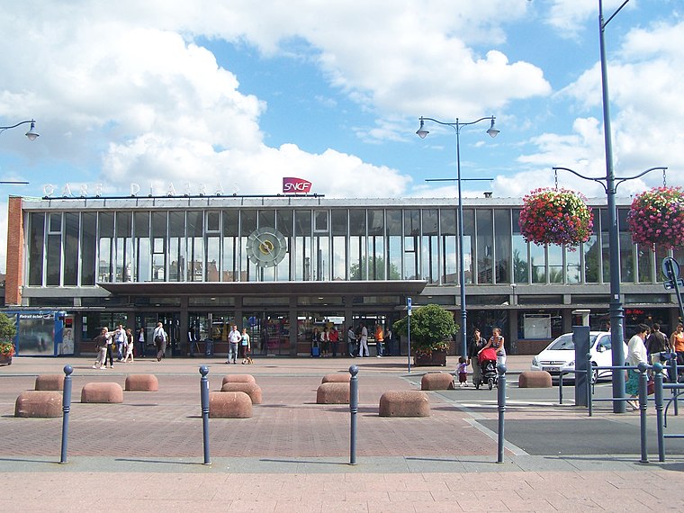
Photo: Floflo, CC BY-SA 3.0.
Arras station is a railway station serving the town Arras, Pas-de-Calais department, northern France. This station, which opened in 1846, is located on the Paris–Lille railway and Arras-Dunkirk railway and accessible from LGV Nord. Arras station is situated 700 metres northwest of Direction de la Communication.
Wellington Quarry Museum WW1
Museum

Photo: ChrisO, CC BY-SA 3.0.
The Carrière Wellington is a museum in Arras, northern France. It is named after a former underground quarry which was part of a network of tunnels used by forces of the British Empire and Commonwealth during the First World War. Wellington Quarry Museum WW1 is situated 600 metres southwest of Direction de la Communication.
Hôtel de ville
Town hall

Photo: Jean-Pol GRANDMONT, CC BY 4.0.
The Hôtel de Ville is a historic building in Arras, Pas-de-Calais, northern France, standing at the northwest end of the Place Des Heros in the centre of the town, and its bell-tower representing the main landmark in the town. Hôtel de ville is situated 1¼ km northwest of Direction de la Communication.
Places in the Area
Nearby places include Monchy-le-Preux.
Monchy-le-Preux
Village

Photo: Pir6mon, CC BY-SA 3.0.
Monchy-le-Preux is a commune in the Pas-de-Calais department in the Hauts-de-France region of France ten kilometres southeast of Arras. Monchy-le-Preux is situated 8 km east of Direction de la Communication.
Direction de la Communication
- Type: Government office
- Wheelchair access: yes
- Categories: office and government building
- Location: Arras, Arrondissement of Arras, Pas-de-Calais, Hauts-de-France, France, Europe
- View on OpenStreetMap
Latitude
50.2833° or 50° 16′ 60″ northLongitude
2.79008° or 2° 47′ 24″ eastOperator
Département du Pas-de-CalaisOpen location code
9F247QMR+82OpenStreetMap ID
node 10120486593OpenStreetMap feature
office=governmentOpenStreetMap attribute
wheelchair=yes
This page is based on OpenStreetMap, Wikidata, and Wikimedia Commons.
We’d love your help improving our open data sources. Thank you for contributing.
Satellite Map
Discover Direction de la Communication from above in high-definition satellite imagery.
Notable Places Nearby
Highlights include Maison Départementale de l’Aménagement et du Développement Territorial de l’Arrageois and Bibliothèque Robinson.
Nearby Places
Explore places such as Atelier Canopé 62 and Temple.
Hauts-de-France: Must-Visit Destinations
Delve into Lille, Dunkirk, Calais, and Amiens.
Curious Government Offices to Discover
Uncover intriguing government offices from every corner of the globe.
About Mapcarta. Data © OpenStreetMap contributors and available under the Open Database License". Text is available under the CC BY-SA 4.0 license, except for photos, directions, and the map. Photo: Mélanie Huguet, CC BY-SA 3.0.