Muchael kors
Muchael kors is a bag shop in Ami Machi, Inashiki district, Ibaraki. Muchael kors is situated nearby to the shopping center Ami Premium Outlets, as well as near the tollbooth Ami-higashi IC.| Tap on a place to explore it |
Places of Interest Nearby
Highlights include AMI PREMIUM OUTLETS and Ushiku Daibutsu.
AMI PREMIUM OUTLETS
Shopping center
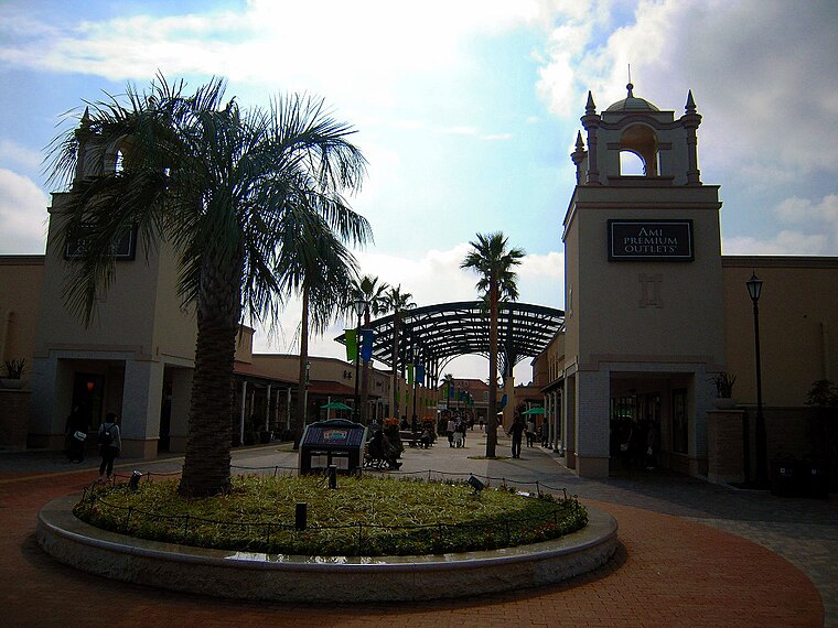
Photo: Mutimaro, CC BY-SA 3.0.
AMI PREMIUM OUTLETS is a shopping center.
Ushiku Daibutsu
Work of art

Photo: Wikimedia, Public domain.
Ushiku Daibutsu is a statue located in Ushiku, Ibaraki Prefecture, Japan. Completed in 1993, it stands a total of 120 metres tall, including the 10 m base and 10 m lotus platform. Ushiku Daibutsu is situated 1½ km west of Muchael kors.

Places in the Area
Nearby places include Ami and Miho.
Ami
Town

Photo: Wikimedia, CC BY-SA 3.0.
Ami is a town located in Ibaraki Prefecture, Japan. As of 1 October 2020, the town had an estimated population of 47,927 in 20,279 households and a population density of 671 persons per km2. Ami is situated 6 km north of Muchael kors.
Miho
Village

Photo: Wikimedia, CC BY-SA 3.0.
Miho is a village located in Ibaraki Prefecture, Japan. As of 1 October 2020, the village had an estimated population of 14,504 in 5907 households and a population density of 218 persons per km2. Miho is situated 6 km east of Muchael kors.
Ushiku

Photo: Wiiii, CC BY-SA 3.0.
Ushiku is a city located in Ibaraki Prefecture, Japan. As of 1 January 2024, the city had an estimated population of 83,826 in 36,380 households and a population density of 1423 persons per km2.
Muchael kors
- Type: Bag shop
- Category: shop
- Location: Ami Machi, Inashiki district, Ibaraki, Kanto, Japan, East Asia, Asia
- View on OpenStreetMap
Latitude
35.98376° or 35° 59′ 2″ northLongitude
140.2374° or 140° 14′ 15″ eastOpen location code
8R72X6MP+GXOpenStreetMap ID
node 10132699429OpenStreetMap feature
shop=bag
This page is based on OpenStreetMap, Wikidata, and Wikimedia Commons.
We’d love your help improving our open data sources. Thank you for contributing.
Satellite Map
Discover Muchael kors from above in high-definition satellite imagery.
Notable Places Nearby
Highlights include Ami Premium Outlets and Ami-higashi IC.
Nearby Places
Explore places such as Cole haan and Furla.
Ibaraki: Must-Visit Destinations
Delve into Mito, Tsukuba, Hitachi, and Tsuchiura.
Curious Bag Shops to Discover
Uncover intriguing bag shops from every corner of the globe.
About Mapcarta. Data © OpenStreetMap contributors and available under the Open Database License". Text is available under the CC BY-SA 4.0 license, except for photos, directions, and the map. Photo: Polimerek, CC BY-SA 3.0.