Steinkimmen Jugendhof
Steinkimmen Jugendhof is an electrical substation in Hatten, Oldenburg, Lower Saxony. Steinkimmen Jugendhof is situated nearby to the meadow Hirsh Pharm, as well as near the village Dingstede.| Tap on a place to explore it |
Places of Interest Nearby
Highlights include Megalithic stones of Steinkimmen and Falkensteinsee.
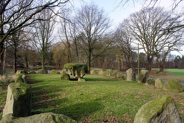
Megalithic stones of Steinkimmen
Archaeological site

Photo: Ralf Krebs, CC BY 3.0.
Megalithic stones of Steinkimmen is an archaeological site, which is situated 2 km northeast of Steinkimmen Jugendhof.
Falkensteinsee
Lake

Photo: Rieke.meiners, CC BY-SA 4.0.
Falkensteinsee is a lake, which is situated 2½ km northeast of Steinkimmen Jugendhof.
Geer Moor
Nature reserve

Photo: Ralf Krebs, CC BY 3.0.
Geer Moor is a nature reserve, which is situated 3 km southwest of Steinkimmen Jugendhof.
Places in the Area
Nearby places include Dingstede and Steinkimmen.


Steinkimmen Jugendhof
- Type: Electrical substation
- Category: industry
- Location: Hatten, Oldenburg, Lower Saxony, Germany, Central Europe, Europe
- View on OpenStreetMap
Latitude
53.03196° or 53° 1′ 55″ northLongitude
8.43501° or 8° 26′ 6″ eastOperator
EWE NetzOpen location code
9F5C2CJP+Q2OpenStreetMap ID
node 10171460854OpenStreetMap feature
man_made=street_cabinet
This page is based on OpenStreetMap, Wikidata, and Wikimedia Commons.
We’d love your help improving our open data sources. Thank you for contributing.
Satellite Map
Discover Steinkimmen Jugendhof from above in high-definition satellite imagery.
Notable Places Nearby
Highlights include Hirsh Pharm and Großsteingrab Steinkimmen 3.
Nearby Places
Explore places such as Natursiedlung „Zum Steinring“ and grünes Haus.
Lower Saxony: Must-Visit Destinations
Delve into Hanover, Göttingen, Brunswick, and Wolfsburg.
Curious Electrical Substations to Discover
Uncover intriguing electrical substations from every corner of the globe.
About Mapcarta. Data © OpenStreetMap contributors and available under the Open Database License". Text is available under the CC BY-SA 4.0 license, except for photos, directions, and the map. Photo: Danapit, CC BY-SA 3.0.