Atras Padaria Victoria
Atras Padaria Victoria is a bus stop in Cape Verde. Atras Padaria Victoria is situated nearby to the church Igreja Universal do Reino de Deus, as well as near the police station Posto Policial de Fonte Inês.| Tap on a place to explore it |
Places of Interest Nearby
Highlights include Estádio Municipal Adérito Sena and Praça Amílcar Cabral.
Estádio Municipal Adérito Sena
Stadium
Estádio Municipal Adérito Sena is a multi-use stadium in Mindelo, Cape Verde. It is currently used mostly for football matches and is the home stadium of FC Derby as well as CS Mindelense, Académica, GD Amarantes and Batuque FC and the lesser club of Corinthians São Vicente. Estádio Municipal Adérito Sena is situated 1¼ km southwest of Atras Padaria Victoria.
Praça Amílcar Cabral
Park

Photo: Balou46, CC BY-SA 4.0.
Praça Amílcar Cabral, also popularly known as Praça Nova, is an important square of the city of Mindelo, São Vicente, Cape Verde. It is located in the northern part of the city center of Mindelo. Praça Amílcar Cabral is situated 1¼ km west of Atras Padaria Victoria.
Fortim d’El-Rei
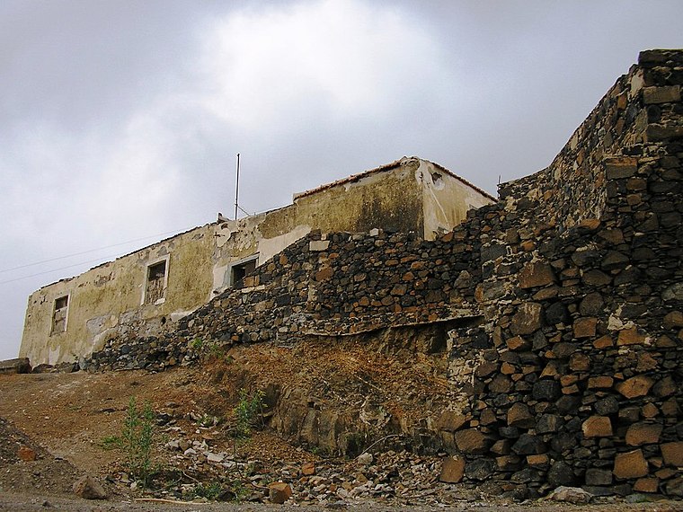
Photo: Manuel de Sousa, CC BY-SA 3.0.
Fortim d'El Rei is a fort in Mindelo, in the island of São Vicente, Cape Verde. It is located on a hill north of the city centre, in the neighbourhood Fortinho. Fortim d’El-Rei is situated 2 km west of Atras Padaria Victoria.
Places in the Area
Nearby places include Ribeira Bote and Alto Miramar.
Ribeira Bote
Suburb

Photo: Manuel de Sousa, CC BY-SA 3.0.
Ribeira Bote is a subdivision of the city of Mindelo in the island of São Vicente, Cape Verde. Its population was 3,956 at the 2010 census. It borders the city centre to the northwest and Fonte Cónego to the north.
Alto Miramar
Suburb

Photo: Kotoviski, CC BY-SA 3.0.
Alto Miramar is a subdivision of the city of Mindelo in the island of São Vicente, Cape Verde. Its population was 524 at the 2010 census. It is situated directly northeast of the city centre.
Mindelo

Photo: Kogo, CC BY-SA 3.0.
Mindelo is on the island of São Vicente. Mindelo is the cultural capital of Cape Verde. You'll hear traditional music commonly played in bars and restaurants around town.
Atras Padaria Victoria
- Type: Bus stop
- Categories: transport stop and transportation
- Location: Cape Verde, Africa
- View on OpenStreetMap
Latitude
16.88888° or 16° 53′ 20″ northLongitude
-24.97579° or 24° 58′ 33″ westOperator
TRANSCOR.SVOpen location code
798QV2QF+HMOpenStreetMap ID
node 10235632703OpenStreetMap feature
public_transport=stop_position
This page is based on OpenStreetMap, Wikidata, and Wikimedia Commons.
We’d love your help improving our open data sources. Thank you for contributing.
Satellite Map
Discover Atras Padaria Victoria from above in high-definition satellite imagery.
Notable Places Nearby
Highlights include Igreja Universal do Reino de Deus and Igreja Universal.
Nearby Places
Explore places such as Cadeia Ribeirinha and Val Verde.
Cape Verde: Must-Visit Destinations
Delve into Praia, Cidade Velha, Mindelo, and Tarrafal.
Curious Bus Stops to Discover
Uncover intriguing bus stops from every corner of the globe.
About Mapcarta. Data © OpenStreetMap contributors and available under the Open Database License". Text is available under the CC BY-SA 4.0 license, except for photos, directions, and the map. Photo: Ximonic, CC BY-SA 3.0.