Ravenski hrib
Ravenski hrib is a peak in Sevnica, Southeastern Slovenia and has an elevation of 415 metres. Ravenski hrib is situated nearby to the hamlet Ravne, as well as near the village Vrh pri Boštanju.| Tap on a place to explore it |
Places of Interest
Highlights include Sevnica train station and Boštanj Hydroelectric Power Plant.
Sevnica train station
Railway station
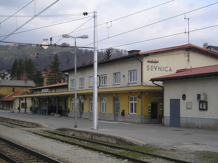
Photo: Ajznponar, CC BY-SA 3.0.
Sevnica train station is a railway station.
Boštanj Hydroelectric Power Plant
Power station

Photo: Eleassar, CC BY-SA 3.0.
Boštanj Hydroelectric Power Plant is a power station.

Places in the Area
Nearby places include Dolenji Boštanj and Boštanj.
Dolenji Boštanj
Village

Photo: Eleassar, CC BY-SA 3.0.
Dolenji Boštanj is a settlement in the Municipality of Sevnica in central Slovenia. It lies near the confluence of the Mirna River with the Sava in Lower Carniola.
Boštanj
Village

Photo: Dh3201, CC BY-SA 3.0.
Boštanj is a village in the Lower Sava Valley in southeastern Slovenia. It consists of a nucleated centre on two terraces on the right bank of the Sava River along the main road from Celje to Krško, and two hamlets, Puše and Redna, on the slopes of the nearby hills.
Vrh pri Boštanju
Village

Photo: Eleassar, CC BY-SA 3.0.
Vrh pri Boštanju is a settlement in the hills southwest of Boštanj in the Municipality of Sevnica in east-central Slovenia. The area is part of the historical region of Lower Carniola.
Ravenski hrib
- Type: Peak with an elevation of 415 metres
- Category: landform
- Location: Sevnica, Southeastern Slovenia, Slovenia, Central Europe, Europe
- View on OpenStreetMap
Latitude
46.0061° or 46° 0′ 22″ northLongitude
15.2688° or 15° 16′ 8″ eastElevation
415 metres (1,362 feet)Open location code
8FRQ2749+CGOpenStreetMap ID
node 10291941965OpenStreetMap feature
natural=peak
This page is based on OpenStreetMap, Wikidata, and Wikimedia Commons.
We’d love your help improving our open data sources. Thank you for contributing.
Satellite Map
Discover Ravenski hrib from above in high-definition satellite imagery.
Places with the Same Name
Discover other places named “Ravenski hrib”.
Localities in the Area
Explore places such as Ravne and Topolovec.
Notable Places Nearby
Highlights include Marijino vnebovzetje and Tičnica.
Southeastern Slovenia: Must-Visit Destinations
Delve into Novo Mesto, Brežice, and Ribnica.
Curious Peaks to Discover
Uncover intriguing peaks from every corner of the globe.
About Mapcarta. Data © OpenStreetMap contributors and available under the Open Database License". Text is available under the CC BY-SA 4.0 license, except for photos, directions, and the map. Photo: Eleassar, CC BY-SA 3.0.