Av Sta Iria (Pass Sup)
Av Sta Iria (Pass Sup) is a bus stop in Santa Iria de Azoia, São João da Talha e Bobadela, Loures, Lisbon District. Av Sta Iria (Pass Sup) is situated nearby to the post office CTT, as well as near the swimming pool Piscinas Municipais de Santa Iria de Azóia.| Tap on a place to explore it |
Places of Interest Nearby
Highlights include Igreja Matriz de Santa Iria de Azóia and Santa Iria train station.
Igreja Matriz de Santa Iria de Azóia
Church

Photo: Vitor Oliveira, CC BY-SA 2.0.
Igreja Matriz de Santa Iria de Azóia is a church, which is situated 350 metres southwest of Av Sta Iria (Pass Sup).
Santa Iria train station
Railway stop

Photo: GualdimG, CC BY-SA 4.0.
Santa Iria train station is a railway stop, which is situated 710 metres south of Av Sta Iria (Pass Sup).
Castle of Pirescoxe
Castle
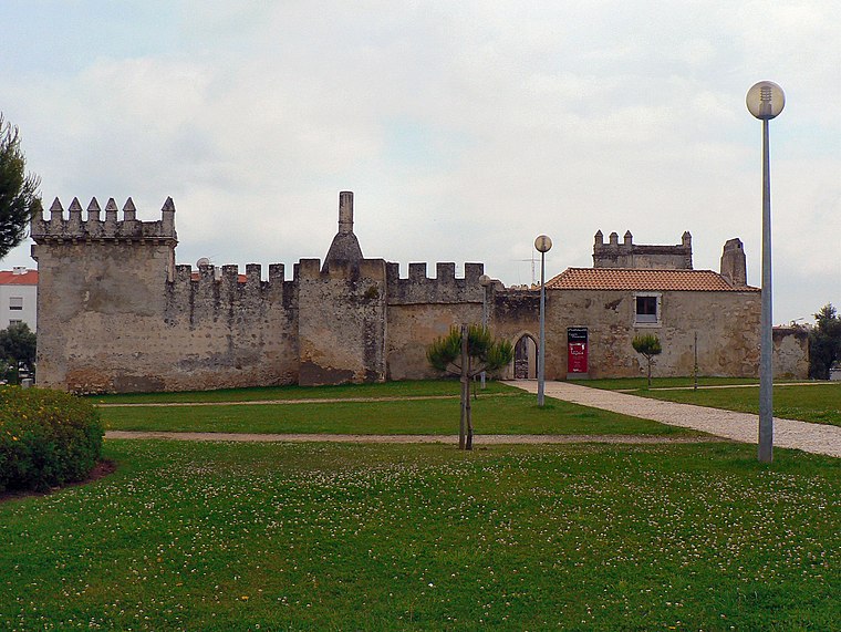
Photo: Juntas, CC BY-SA 2.5.
The Castle of Pirescoxe is a castle located in Santa Iria de Azoia, in the municipality of Loures, Portugal. It is classified by IGESPAR as a site of public interest. Castle of Pirescoxe is situated 1¼ km southwest of Av Sta Iria (Pass Sup).
Places in the Area
Nearby places include Santa Iria de Azoia and Pirescoxe.
Santa Iria de Azoia
Town

Photo: Juntas, CC BY-SA 3.0.
Santa Iria de Azoia is a town and former freguesia in the municipality of Loures, Portugal. Since 2013, it is part of the freguesia Santa Iria de Azoia, São João da Talha e Bobadela. Its population in 2011 was 18,240.

Vialonga
Town

Photo: Vitor Oliveira, CC BY-SA 2.0.
Vialonga is a town and freguesia in the municipality of Vila Franca de Xira, Portugal. Its population in 2021 was 21,261. Vialonga is situated 3 km north of Av Sta Iria (Pass Sup).
Av Sta Iria (Pass Sup)
- Type: Bus stop
- Category: transportation
- Location: Santa Iria de Azoia, São João da Talha e Bobadela, Loures, Lisbon District, Portugal, Iberia, Europe
- View on OpenStreetMap
Latitude
38.84705° or 38° 50′ 49″ northLongitude
-9.08297° or 9° 4′ 59″ westNetwork
Carris MetropolitanaOpen location code
8CCGRWW8+RROpenStreetMap ID
node 10296424463OpenStreetMap feature
highway=bus_stopOpenStreetMap feature
public_transport=platform
This page is based on OpenStreetMap, Wikidata, and Wikimedia Commons.
We’d love your help improving our open data sources. Thank you for contributing.
Satellite Map
Discover Av Sta Iria (Pass Sup) from above in high-definition satellite imagery.
Notable Places Nearby
Highlights include CTT and Piscinas Municipais de Santa Iria de Azóia.
Nearby Places
Explore places such as Av Sta Iria (Pass Sup) and Millennium bcp.
Portugal: Must-Visit Destinations
Delve into Lisbon, Caldas da Rainha, Porto, and Coimbra.
Curious Bus Stops to Discover
Uncover intriguing bus stops from every corner of the globe.
About Mapcarta. Data © OpenStreetMap contributors and available under the Open Database License". Text is available under the CC BY-SA 4.0 license, except for photos, directions, and the map. Photo: Vitor Oliveira, CC BY-SA 2.0.