A-das-Lebres (Serração)
A-das-Lebres (Serração) is a bus stop in Santo Antão e São Julião do Tojal, Loures, Lisbon District. A-das-Lebres (Serração) is situated nearby to the park Parque desportivo, as well as near the power station Central Fotovoltaica de Malhapão.| Tap on a place to explore it |
Places of Interest Nearby
Highlights include Palácio da Mitra, aqueduto, pombais, chafarizes, igreja, monumental portão de entrada e toda a área murada da antiga quinta and Anta de Casaínhos.
Palácio da Mitra, aqueduto, pombais, chafarizes, igreja, monumental portão de entrada e toda a área murada da antiga quinta
Castle
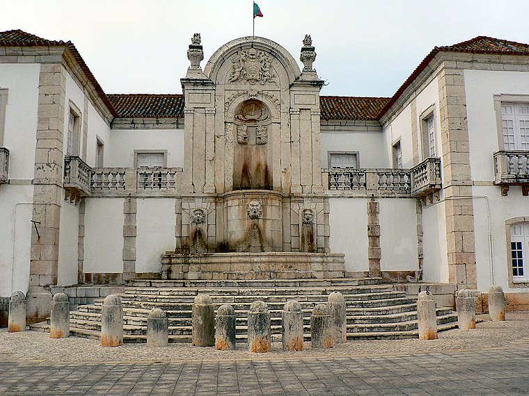
Photo: Juntas, CC BY-SA 2.5.
Palácio da Mitra, aqueduto, pombais, chafarizes, igreja, monumental portão de entrada e toda a área murada da antiga quinta is a castle, which is situated 2½ km east of A-das-Lebres (Serração).
Anta de Casaínhos
Archaeological site

Photo: Juntas, CC BY-SA 3.0.
Anta de Casaínhos is an archaeological site, which is situated 2½ km north of A-das-Lebres (Serração).
Igreja Matriz de Santo Antão do Tojal
Church

Photo: Juntas, CC BY-SA 2.5.
Igreja Matriz de Santo Antão do Tojal is a church, which is situated 2½ km east of A-das-Lebres (Serração).
Places in the Area
Nearby places include Santo Antão do Tojal and Fanhões.

Fanhões
Village

Photo: Wikimedia, CC BY-SA 2.5.
Fanhões is a village, which is situated 3 km northeast of A-das-Lebres (Serração).
Frielas
Village

Photo: Juntas, CC BY-SA 2.5.
Frielas is a former civil parish in the municipality of Loures, Lisbon District, Portugal. In 2013, the parish merged into the new parish Santo António dos Cavaleiros e Frielas. Frielas is situated 4 km southeast of A-das-Lebres (Serração).
A-das-Lebres (Serração)
- Type: Bus stop
- Category: transportation
- Location: Santo Antão e São Julião do Tojal, Loures, Lisbon District, Portugal, Iberia, Europe
- View on OpenStreetMap
Latitude
38.85733° or 38° 51′ 26″ northLongitude
-9.1677° or 9° 10′ 4″ westNetwork
Carris MetropolitanaOpen location code
8CCGVR4J+WWOpenStreetMap ID
node 10296425046OpenStreetMap feature
highway=bus_stopOpenStreetMap feature
public_transport=platform
This page is based on OpenStreetMap, Wikidata, and Wikimedia Commons.
We’d love your help improving our open data sources. Thank you for contributing.
Satellite Map
Discover A-das-Lebres (Serração) from above in high-definition satellite imagery.
Notable Places Nearby
Highlights include Parque desportivo and Central Fotovoltaica de Malhapão.
Nearby Places
Explore places such as A-das-Lebres (Serração) and Reservatório.
Portugal: Must-Visit Destinations
Delve into Lisbon, Caldas da Rainha, Porto, and Coimbra.
Curious Bus Stops to Discover
Uncover intriguing bus stops from every corner of the globe.
About Mapcarta. Data © OpenStreetMap contributors and available under the Open Database License". Text is available under the CC BY-SA 4.0 license, except for photos, directions, and the map. Photo: Vitor Oliveira, CC BY-SA 2.0.