Manforter Kiosk
Manforter Kiosk is a newsagent in Leverkusen, Cologne District, North Rhine-Westphalia which is located on Manforter Straße. Manforter Kiosk is situated nearby to the public building Katholische Familienbildungsstätte, as well as near the sports venue Sportcenter Samurai.| Tap on a place to explore it |
- Opening hours:
Monday—Friday: 5:00 AM—1:00 AM
Saturday: 6:00 AM—1:00 AM
Sunday: 8:00 AM—1:00 AM - Type: Newsagent
- Address: Manforter Straße 241, Leverkusen, 51373
Places of Interest Nearby
Highlights include Leverkusen-Manfort station and St. Joseph.
Leverkusen-Manfort station
Railway station

Photo: A.Savin, CC BY-SA 3.0.
Leverkusen-Manfort station is a through station in the district of Manfort of the city of Leverkusen in the German state of North Rhine-Westphalia. It was named after the nearby town of Schlebusch and opened on 25 August 1867 on the Gruiten–Köln-Deutz railway, which was completed between the former Bergisch-Märkische Railway Company station in Mülheim and Opladen by the BME on 1 May 1868. Leverkusen-Manfort station is situated 560 metres east of Manforter Kiosk.
St. Joseph
Church

Photo: René Hirsch, CC BY-SA 3.0.
St. Joseph is a church, which is situated 460 metres northeast of Manforter Kiosk.
Ulrich-Haberland-Stadion
Stadium
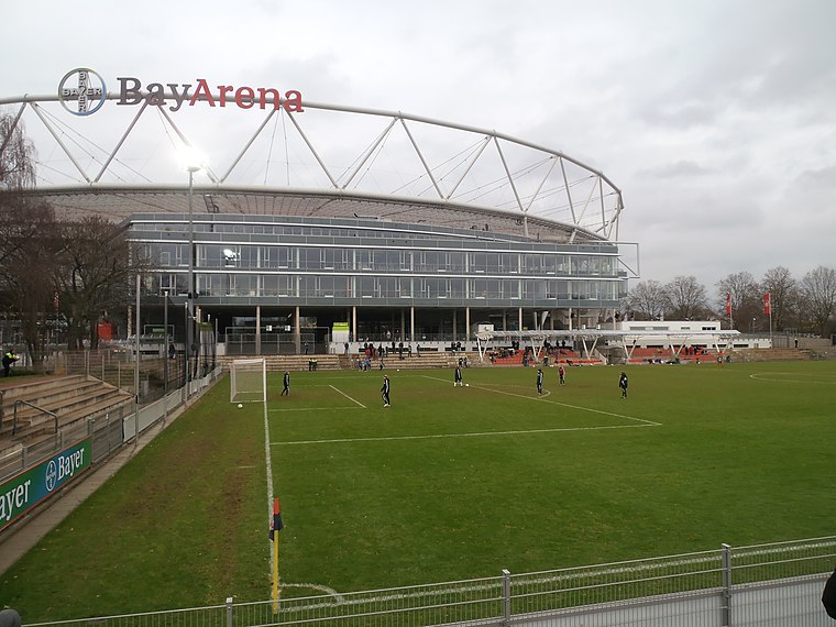
Photo: Hobby-Fotograf2013, CC BY-SA 3.0.
Ulrich-Haberland-Stadion is a stadium, which is situated 1 km northwest of Manforter Kiosk.
Places in the Area
Nearby places include Opladen and Biesenbach.
Opladen
Suburb
Opladen, now a district of Leverkusen, used to be the capital of the Rhein-Wupper-Kreis until 1975. Opladen station is located 15 kilometres northeast from Cologne on the railway to Wuppertal. Opladen is situated 4 km north of Manforter Kiosk.
Biesenbach
Village

Photo: DiAuras, CC BY-SA 4.0.
Biesenbach is a village, which is situated 5 km northeast of Manforter Kiosk.
Köln-Rheinkassel
Village

Photo: Elya, CC BY-SA 3.0.
Köln-Rheinkassel is a village, which is situated 5 km west of Manforter Kiosk.
Manforter Kiosk
- Category: shop
- Location: Leverkusen, Cologne District, Cologne Lowland, North Rhine-Westphalia, Germany, Central Europe, Europe
- View on OpenStreetMap
Latitude
51.03047° or 51° 1′ 50″ northLongitude
7.00729° or 7° 0′ 26″ eastOpen location code
9F3922J4+5WOpenStreetMap ID
node 10303747009OpenStreetMap feature
shop=newsagent
This page is based on OpenStreetMap, Wikidata, and Wikimedia Commons.
We’d love your help improving our open data sources. Thank you for contributing.
Satellite Map
Discover Manforter Kiosk from above in high-definition satellite imagery.
Notable Places Nearby
Highlights include Katholische Familienbildungsstätte and Sportcenter Samurai.
Nearby Places
Explore places such as Damian-Apotheke and Brauhaus Manforter Hof.
Cologne Lowland: Must-Visit Destinations
Delve into Cologne, Bonn, Siegburg, and Bad Honnef.
Curious Newsagents to Discover
Uncover intriguing newsagents from every corner of the globe.
About Mapcarta. Data © OpenStreetMap contributors and available under the Open Database License". Text is available under the CC BY-SA 4.0 license, except for photos, directions, and the map. Photo: A.Savin, CC BY-SA 3.0.