Station 11 - Flachsbauer
Station 11 - Flachsbauer is a playground in Leutkirch im Allgäu, Ravensburg, Baden-Württemberg. Station 11 - Flachsbauer is situated nearby to the playground Station 10 - Gerber, as well as near Station 6 - Schmid.| Tap on a place to explore it |
Places of Interest Nearby
Highlights include Château Hummelsberg and Pulverturm.
Château Hummelsberg
Building

Photo: Richard Mayer, CC BY-SA 3.0.
Château Hummelsberg is a building, which is situated 300 metres south of Station 11 - Flachsbauer.
Pulverturm
Building
The Leutkirch Pulverturm or Leutkirch Powder Tower was built towards the end of the 17th century on the southeast corner of Leutkirch im Allgäu, Baden-Württemberg, Germany, as part of the rebuilding of the collapsed town wall. Pulverturm is situated 310 metres southwest of Station 11 - Flachsbauer.
Leutkirch station
Railway station
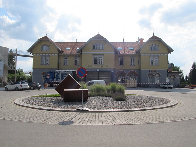
Photo: Lenni-2011, CC BY-SA 3.0.
Leutkirch station is the station of the town of Leutkirch im Allgäu in the German state of Baden-Württemberg. It is classified by Deutsche Bahn as a category 5 station and has two platform tracks. Leutkirch station is situated 1 km west of Station 11 - Flachsbauer.
Places in the Area
Nearby places include Herlazhofen and Tautenhofen.
Herlazhofen
Village

Photo: Richard Mayer, CC BY-SA 3.0.
Herlazhofen is a village in the South-German region Allgäu. It is part of the town Leutkirch im Allgäu. The population is approximately 1000 inhabitants. Herlazhofen is situated 4 km south of Station 11 - Flachsbauer.
Tautenhofen
Village
 Tautenhofen is a village, which is situated 4 km southwest of Station 11 - Flachsbauer.
Unterzeil
Village

Photo: Richard Mayer, CC BY 3.0.
Unterzeil is a village, which is situated 4 km northwest of Station 11 - Flachsbauer.
Station 11 - Flachsbauer
- Type: Playground
- Category: recreation area
- Location: Leutkirch im Allgäu, Ravensburg, Tübingen Region, Baden-Württemberg, Germany, Central Europe, Europe
- View on OpenStreetMap
Latitude
47.82702° or 47° 49′ 37″ northLongitude
10.02891° or 10° 1′ 44″ eastOpen location code
8FVGR2GH+RHOpenStreetMap ID
node 10310890410OpenStreetMap feature
leisure=playground
This page is based on OpenStreetMap, Wikidata, and Wikimedia Commons.
We’d love your help improving our open data sources. Thank you for contributing.
Satellite Map
Discover Station 11 - Flachsbauer from above in high-definition satellite imagery.
Notable Places Nearby
Highlights include Station 10 - Gerber and Station 6 - Schmid.
Nearby Places
Explore places such as Kriegerdenkmal and Grundschule Oberer Graben.
Baden-Württemberg: Must-Visit Destinations
Delve into Stuttgart, Heidelberg, Karlsruhe, and Mannheim.
Curious Playgrounds to Discover
Uncover intriguing playgrounds from every corner of the globe.
About Mapcarta. Data © OpenStreetMap contributors and available under the Open Database License". Text is available under the CC BY-SA 4.0 license, except for photos, directions, and the map. Photo: Traveler100, CC BY-SA 3.0.