Schleißrücken
Schleißrücken is a peak in Spalt, Roth, Bavaria and has an elevation of 492 metres. Schleißrücken is situated nearby to the hamlet Keilberg, as well as near the village Stockheim.| Tap on a place to explore it |
Places of Interest
Highlights include Stauwurzel des Igelsbachsees and Schnittlinger Loch.


Places in the Area
Nearby places include Franconian Lake District and Absberg.
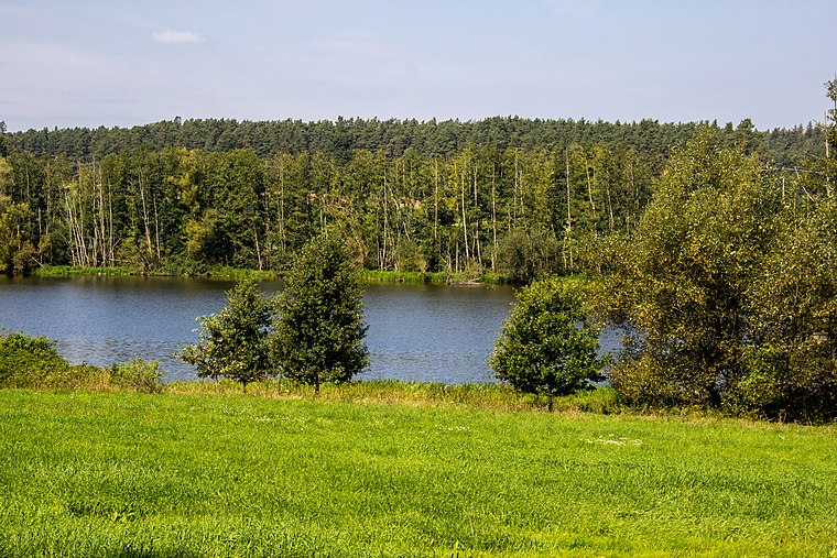
Franconian Lake District

Photo: Wolkenkratzer, CC BY-SA 4.0.
The Franconian Lake District is to the south-west of Nuremberg in Germany. The Lake District comprises 7 lakes and several “waters”.
Absberg
Village

Photo: Wolkenkratzer, CC BY-SA 4.0.
Absberg is a municipality in the Weißenburg-Gunzenhausen district, in Bavaria, Germany. The Absberg family was named by this place and had their home castle there.

Schleißrücken
- Type: Peak with an elevation of 492 metres
- Description: hill west of Stockheim (Spalt), Middle Franconia, Germany
- Categories: hill and landform
- Location: Spalt, Roth, Middle Franconia, Franconia, Bavaria, Germany, Central Europe, Europe
- View on OpenStreetMap
Latitude
49.1604° or 49° 9′ 37″ northLongitude
10.888° or 10° 53′ 17″ eastElevation
492 metres (1,614 feet)Open location code
8FXG5V6Q+55OpenStreetMap ID
node 10311441035OpenStreetMap feature
natural=peakWikidata ID
Q116050897
This page is based on OpenStreetMap, Wikidata, and Wikimedia Commons.
We’d love your help improving our open data sources. Thank you for contributing.
Satellite Map
Discover Schleißrücken from above in high-definition satellite imagery.
In Other Languages
“Schleißrücken” goes by many names.
- German: “Schleißrücken”
Localities in the Area
Explore places such as Keilberg and Stockheim.
Notable Places Nearby
Highlights include Boundary marker and Hasenbuck.
Middle Franconia: Must-Visit Destinations
Delve into Nuremberg, Erlangen, Fürth, and Ansbach.
Curious Peaks to Discover
Uncover intriguing peaks from every corner of the globe.
About Mapcarta. Data © OpenStreetMap contributors and available under the Open Database License". Text is available under the CC BY-SA 4.0 license, except for photos, directions, and the map. Photo: Berthold Werner, CC0.