Almancil-Nexe
Almancil-Nexe is a bus stop in Almancil, Loulé, Faro District. Almancil-Nexe is situated nearby to the railway station Estação Ferroviária de Parque das Cidades, as well as near Parque das Cidades train station.| Tap on a place to explore it |
Places of Interest Nearby
Highlights include Almancil-Nexe Halt and Estádio Algarve.
Almancil-Nexe Halt
Railway station

Photo: Jipeman, CC BY-SA 4.0.
Almancil-Nexe Halt is a railway station.
Estádio Algarve
Stadium
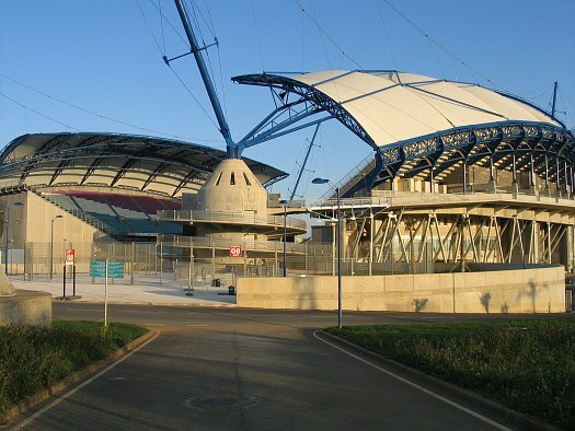
Photo: Wikimedia, CC BY-SA 2.0.
The Estádio Algarve is an association football stadium located between Faro and Loulé municipalities, in the Algarve region of Portugal. The stadium has a total capacity of 30,305 spectators and was purposely built for the UEFA Euro 2004 championship. Estádio Algarve is situated 1¼ km east of Almancil-Nexe.
Parque das Cidades train station
Railway station

Photo: Ajpvalente, CC BY 3.0.
Parque das Cidades train station is a railway station, which is situated 610 metres southeast of Almancil-Nexe.
Places in the Area
Nearby places include Santa Bárbara de Nexe and Faro.
Santa Bárbara de Nexe
Village
Santa Bárbara de Nexe is a village and civil parish in the Portuguese municipality of Faro on the southern Algarve region. The population in 2011 was 4,116, in an area of 38.22 km². It is located a few kilometers from both the cities of Loulé and Faro. Santa Bárbara de Nexe is situated 3 km northeast of Almancil-Nexe.
Faro

Photo: Inkey, CC BY-SA 2.0.
Faro is a city in the Algarve region of Portugal that is a popular sun destination in the summer, and a base for exploring the surrounding area.
Almancil-Nexe
- Type: Bus stop
- Category: transportation
- Location: Almancil, Loulé, Faro District, Algarve, Portugal, Iberia, Europe
- View on OpenStreetMap
Latitude
37.08479° or 37° 5′ 5″ northLongitude
-7.98883° or 7° 59′ 20″ westOperator
Vamus AlgarveNetwork
Vamus AlgarveOpen location code
8C9J32M6+WFOpenStreetMap ID
node 10317454529OpenStreetMap feature
highway=bus_stopOpenStreetMap feature
public_transport=platform
This page is based on OpenStreetMap, Wikidata, and Wikimedia Commons.
We’d love your help improving our open data sources. Thank you for contributing.
Satellite Map
Discover Almancil-Nexe from above in high-definition satellite imagery.
Places with the Same Name
Discover other places named “Almancil-Nexe”.
Notable Places Nearby
Highlights include Estação Ferroviária de Parque das Cidades and Ermida de São João da Venda.
Nearby Places
Explore places such as Almancil-Nexe and Café Bento.
Algarve: Must-Visit Destinations
Delve into Faro, Portimão, Lagos, and Tavira.
Curious Bus Stops to Discover
Uncover intriguing bus stops from every corner of the globe.
About Mapcarta. Data © OpenStreetMap contributors and available under the Open Database License". Text is available under the CC BY-SA 4.0 license, except for photos, directions, and the map. Photo: Michael Gaylard, CC BY 2.0.