Ricardo Fabrega
Ricardo Fabrega is a memorial in Gádor, Almería, Andalusia. Ricardo Fabrega is situated nearby to the nature reserve Tabernas Desert.| Tap on a place to explore it |
Places of Interest Nearby
Highlights include Tabernas Desert and Western Leone.
Tabernas Desert
Nature reserve
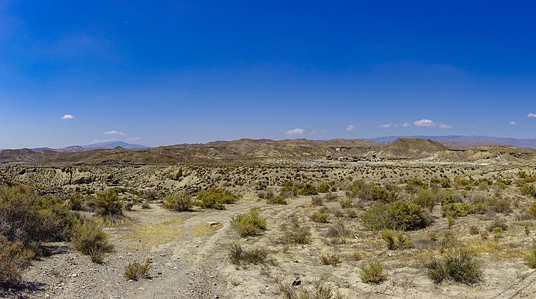 The Tabernas Desert is a desert located within Spain's south-eastern province of Almería. It is in the interior, about 30 kilometers north of the provincial capital Almería, in the Tabernas municipality in Andalusia. Tabernas Desert is situated 3 km northwest of Ricardo Fabrega.
Western Leone
Theme park
 Western Leone is a Western-style theme park in the province of Almeria, Andalusia. Located at the 378.9 km mark on the A-92 motorway, it is the smallest of three such theme parks in the Tabernas Desert; the other two are Mini Hollywood and Texas Hollywood. Western Leone is situated 4 km southeast of Ricardo Fabrega.
El Cóndor fortress

Photo: Jaime Cantero Dole, CC BY-SA 4.0.
El Cóndor fortress is situated 3½ km southeast of Ricardo Fabrega.
Places in the Area
Nearby places include Tabernas and Gérgal.
Tabernas
Village

Photo: Luis Rogelio HM, CC BY-SA 2.0.
Tabernas is a municipality of Almería province, in the autonomous community of Andalusia, Spain, as well as the name of the principal town of the municipality. Tabernas is situated 8 km east of Ricardo Fabrega.
Gérgal
Village

Photo: Schumi4ever, CC BY-SA 3.0.
Gérgal is a municipality of Almería province, in the autonomous community of Andalusia, Spain. The town is located at the foot of the southern side of the Sierra de Los Filabres. Gérgal is situated 9 km northwest of Ricardo Fabrega.
Ricardo Fabrega
- Type: Memorial
- Category: historic site
- Location: Gádor, Almería, Andalusia, Spain, Iberia, Europe
- View on OpenStreetMap
Latitude
37.05553° or 37° 3′ 20″ northLongitude
-2.47729° or 2° 28′ 38″ westOpen location code
8C9V3G4F+63OpenStreetMap ID
node 10594290125OpenStreetMap feature
historic=memorial
This page is based on OpenStreetMap, Wikidata, and Wikimedia Commons.
We’d love your help improving our open data sources. Thank you for contributing.
Satellite Map
Discover Ricardo Fabrega from above in high-definition satellite imagery.
Notable Places Nearby
Highlights include Homenaje a las víctimas del Caso Almería and Colas de Dragón.
Nearby Places
Explore places such as Western Leone Parking and Yin y Yang.
Almería: Must-Visit Destinations
Delve into Almería, Sierra Nevada, Roquetas de Mar, and Adra.
Curious Memorials to Discover
Uncover intriguing memorials from every corner of the globe.
About Mapcarta. Data © OpenStreetMap contributors and available under the Open Database License". Text is available under the CC BY-SA 4.0 license, except for photos, directions, and the map. Photo: isol, CC BY-SA 3.0.