Souls Harbour Rescue Mission
Souls Harbour Rescue Mission is a social service facility in Halifax, Halifax Region, Nova Scotia which is located on Cunard Street. Souls Harbour Rescue Mission is situated nearby to the historic building Halifax Armoury, as well as near the theater building Bus Stop Theatre.| Tap on a place to explore it |
- Email: hello@shrm.ca
- Type: Social service facility
- Address: 5568 Cunard Street, Halifax, B3K 1C4
Places of Interest Nearby
Highlights include Halifax Armoury and St. George’s Church (Halifax, Nova Scotia).
Halifax Armoury
Historic building

Photo: SimonP, CC BY-SA 3.0.
The Halifax Armoury is a military structure in central Halifax, Nova Scotia, Canada. The armoury is the home base of The Princess Louise Fusiliers, and several cadet units.
St. George’s Church (Halifax, Nova Scotia)
Church

Photo: Affabletoaster, CC BY-SA 3.0.
St. George's Round Church is a wooden round church in the neo-Classical Palladian style located in Halifax Regional Municipality in Downtown Halifax. Construction on the church began in 1800 thanks in large part to the financial backing of the British royal family. St. George’s Church (Halifax, Nova Scotia) is situated 300 metres east of Souls Harbour Rescue Mission.
Scotiabank Centre
Stadium
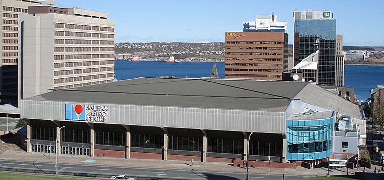
Photo: Bryson109, Public domain.
Scotiabank Centre is the largest multi-purpose facility in Atlantic Canada, located in downtown Halifax, Nova Scotia. The main entrances to the building are located on Brunswick Street, at the corner of Duke Street and Carmichael Street, at the foot of Citadel Hill. Scotiabank Centre is situated 1 km southeast of Souls Harbour Rescue Mission.
Places in the Area
Nearby places include North End and Hydrostone.
North End
Locality

Photo: Citobun, CC BY-SA 4.0.
The North End of Halifax is a neighbourhood of Halifax, Nova Scotia occupying the northern part of Halifax Peninsula immediately north of Downtown Halifax.
Hydrostone
Neighborhood
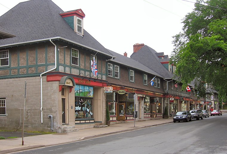
Photo: Verne Equinox, CC BY-SA 3.0.
Hydrostone is a neighbourhood in the North End of the Halifax Peninsula in the Halifax Regional Municipality, Nova Scotia, Canada. It consists of ten short parallel streets and is bordered by Duffus Street to the north, Young Street to the south, Isleville Street to the west and Novalea Drive to the east.
Tufts Cove
Suburb

Photo: Wikimedia, Public domain.
Tufts Cove is an urban neighbourhood in the community of Dartmouth, Nova Scotia, Canada. It is situated on the eastern shore of Halifax Harbour in the North End of Dartmouth. Tufts Cove is situated 2½ km north of Souls Harbour Rescue Mission.
Souls Harbour Rescue Mission
Latitude
44.65242° or 44° 39′ 9″ northLongitude
-63.58645° or 63° 35′ 11″ westOpen location code
87PRMC27+XCOpenStreetMap ID
node 10598340724OpenStreetMap feature
amenity=social_facility
This page is based on OpenStreetMap, Wikidata, and Wikimedia Commons.
We’d love your help improving our open data sources. Thank you for contributing.
Satellite Map
Discover Souls Harbour Rescue Mission from above in high-definition satellite imagery.
Places with the Same Name
Discover other places named “Souls Harbour Rescue Mission”.
Notable Places Nearby
Highlights include Bus Stop Theatre and Halifax Backpackers.
Nearby Places
Explore places such as Lou Pécou and Gate Posts.
Halifax Region: Must-Visit Destinations
Delve into Dartmouth, Enfield, Peggy’s Cove, and Bedford.
Curious Social Service Facilities to Discover
Uncover intriguing social service facilities from every corner of the globe.
About Mapcarta. Data © OpenStreetMap contributors and available under the Open Database License". Text is available under the CC BY-SA 4.0 license, except for photos, directions, and the map. Photo: Balou46, CC BY-SA 4.0.