Hardenbergh’s
Hardenbergh’s is a neighborhood in Lancaster, Nebraska. Hardenbergh’s is situated nearby to the neighborhood Hillsdale, as well as near the quarter Near South.| Tap on a place to explore it |
Places of Interest
Highlights include Thomas P. Kennard House and Statue of Abraham Lincoln.
Thomas P. Kennard House
Historic building

Photo: Ammodramus, CC0.
The Thomas P. Kennard House, also known as the Nebraska Statehood Memorial, is the oldest remaining building in the original plat of Lincoln, Nebraska.
Statue of Abraham Lincoln
Work of art

Photo: Ammodramus, CC0.
Abraham Lincoln – also known as The Gettysburg Lincoln – is a bronze statue of President Abraham Lincoln by Daniel Chester French, located on the grounds of the Nebraska State Capitol.
Nebraska Governor’s Mansion
House

Photo: Atomic Energy505, CC BY-SA 3.0.
The Nebraska Governor's Mansion is the official residence of the governor of Nebraska and his family. Located in Lincoln, Nebraska, it is a modified Georgian Colonial home which began operation as the governor's residence on March 17, 1958.
Places in the Area
Nearby places include Lincoln and Haymarket District.
Lincoln

Photo: Collinulness, CC BY-SA 3.0.
Lincoln is the capital and second largest city of Nebraska, U.S. As the state capital, it offers several historical sites, as well as museums, art galleries, and other cultural venues.
Haymarket District
Suburb
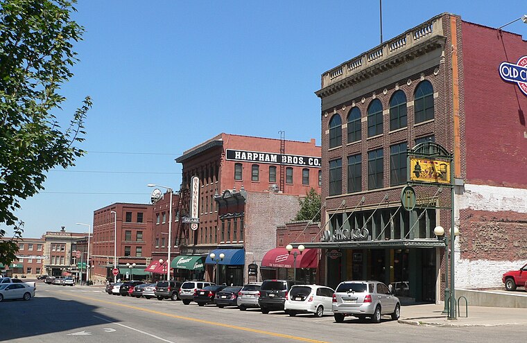
Photo: Ammodramus, CC0.
Haymarket District is a neighborhood and historic district of Downtown Lincoln, Nebraska, United States. The district was created in 1874 and was originally known as Haymarket Square. Haymarket District is situated 2 miles northwest of Hardenbergh’s.
College View
Suburb

Photo: Dysalot, CC BY-SA 4.0.
College View is a neighborhood in southeast Lincoln, Nebraska, United States which was previously a village in Lancaster County. College View is situated 2½ miles southeast of Hardenbergh’s.
Hardenbergh’s
- Type: Neighborhood
- Category: locality
- Location: Lancaster, Nebraska, Great Plains, United States, North America
- View on OpenStreetMap
Latitude
40.79546° or 40° 47′ 44″ northLongitude
-96.68711° or 96° 41′ 14″ westOpen location code
86G5Q8W7+55OpenStreetMap ID
node 10599570473OpenStreetMap feature
place=neighbourhood
This page is based on OpenStreetMap, Wikidata, and Wikimedia Commons.
We’d love your help improving our open data sources. Thank you for contributing.
Satellite Map
Discover Hardenbergh’s from above in high-definition satellite imagery.
Localities in the Area
Explore places such as Hillsdale and Near South.
Notable Places Nearby
Highlights include Grace Lutheran Church and Southview Christian Church.
Nebraska: Must-Visit Destinations
Delve into Omaha, Lincoln, Grand Island, and Kearney.
Curious Neighborhoods to Discover
Uncover intriguing neighborhoods from every corner of the globe.
About Mapcarta. Data © OpenStreetMap contributors and available under the Open Database License". Text is available under the CC BY-SA 4.0 license, except for photos, directions, and the map. Photo: Kahvc7, CC0.