Holzschlag Kirche
Holzschlag Kirche is a bus stop in Unterkohlstätten, Oberwart District, Burgenland. Holzschlag Kirche is situated nearby to the peak Dürrenriegel, as well as near the village Günseck.| Tap on a place to explore it |
Places of Interest Nearby
Highlights include Kath. Filialkirche Mariae Heimsuchung and Bergbaumuseum Goberling.
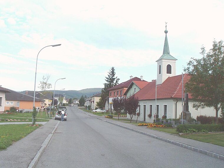
Kath. Filialkirche Mariae Heimsuchung
Church

Photo: Ueb-at, CC BY-SA 3.0.
Kath. Filialkirche Mariae Heimsuchung is a church, which is situated 2 km southeast of Holzschlag Kirche.
Bergbaumuseum Goberling
Museum

Photo: Herzi Pinki, CC BY-SA 4.0.
Bergbaumuseum Goberling is situated 3 km southwest of Holzschlag Kirche.
Pfarrkirche Oberkohlstätten
Church

Photo: Ueb-at, CC BY-SA 3.0.
Pfarrkirche Oberkohlstätten is a church, which is situated 3 km southeast of Holzschlag Kirche.
Places in the Area
Nearby places include Holzschlag and Günseck.

Oberkohlstätten
Village

Photo: Haeferl, CC BY-SA 4.0.
Oberkohlstätten is a village, which is situated 3 km southeast of Holzschlag Kirche.
Holzschlag Kirche
- Type: Bus stop
- Category: transportation
- Location: Unterkohlstätten, Oberwart District, Burgenland, Austria, Central Europe, Europe
- View on OpenStreetMap
Latitude
47.38453° or 47° 23′ 4″ northLongitude
16.3043° or 16° 18′ 16″ eastOpen location code
8FVR98M3+RPOpenStreetMap ID
node 10648447670OpenStreetMap feature
highway=bus_stopOpenStreetMap feature
public_transport=platform
This page is based on OpenStreetMap, Wikidata, and Wikimedia Commons.
We’d love your help improving our open data sources. Thank you for contributing.
Satellite Map
Discover Holzschlag Kirche from above in high-definition satellite imagery.
Notable Places Nearby
Highlights include Dürrenriegel and Steinbruch Pinzker Nr. 21.
Nearby Places
Explore places such as Holzschlag Kirche and Holzschlag Süd.
Burgenland: Must-Visit Destinations
Delve into Eisenstadt, Neusiedl am See, Rust, and Güssing.
Curious Bus Stops to Discover
Uncover intriguing bus stops from every corner of the globe.
About Mapcarta. Data © OpenStreetMap contributors and available under the Open Database License". Text is available under the CC BY-SA 4.0 license, except for photos, directions, and the map. Photo: Wikimedia, CC BY-SA 4.0.