Zona Crepes
Zona Crepes is a café in Santo Domingo De Guzmán (Zona Urbana), Santo Domingo, Nacional. Zona Crepes is situated nearby to the shopping center Centro Comercial Colon, as well as near the college Escula Nacional De Artes Visuales.| Tap on a place to explore it |
Places of Interest Nearby
Highlights include Cathedral of Santo Domingo and Parque Colón.
Cathedral of Santo Domingo
Church

Photo: Georg Karl Ell, CC BY-SA 4.0.
The Cathedral of Santa María la Menor in the Colonial City of Santo Domingo is dedicated to St. Mary of the Incarnation. It is the oldest existing cathedral in the Americas, begun in 1504 and was completed in 1550, and the second constructed after the Garðar Cathedral in Greenland. Cathedral of Santo Domingo is situated 130 metres south of Zona Crepes.
Parque Colón
Park

Photo: Siso84, Public domain.
Parque Colón is the central square of the Ciudad Colonial historic district of Santo Domingo, Dominican Republic. In its center stands a statue of Christopher Columbus, in whose honor the square was renamed in 1887.
Fortaleza Ozama
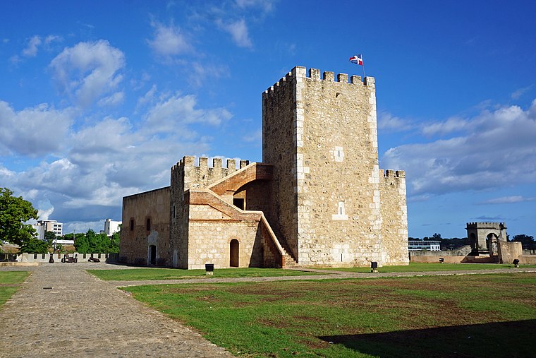
Photo: Mariordo, CC BY-SA 4.0.
The Ozama Fortress, also formerly known as the city wall's Homage tower, is one of the surviving sections of the Walls of Santo Domingo, which is recognized by UNESCO as being the oldest military construction of European origin in the Americas. Fortaleza Ozama is situated 290 metres southeast of Zona Crepes.
Places in the Area
Nearby places include Ciudad Colonial and Los Mameyes.
Ciudad Colonial
Village

Photo: Mariordo, CC BY-SA 4.0.
Ciudad Colonial is the historic central neighborhood of the Dominican Republic's capital Santo Domingo. It is the oldest continuously inhabited European-established settlement in the Americas.
Los Mameyes
Neighborhood
Los Mameyes is a neighbourhood in the city of Santo Domingo Este in the province of Santo Domingo of the Dominican Republic. This neighbourhood is populated in particular by individuals from the middle classes.
Puerto Isabela
Neighborhood
Puerto Isabela is a Sector in the city of Santo Domingo in the Distrito Nacional of the Dominican Republic. This neighborhood is populated in particular by individuals from the middle class. Puerto Isabela is situated 5 km northwest of Zona Crepes.
Zona Crepes
Latitude
18.47411° or 18° 28′ 27″ northLongitude
-69.88375° or 69° 53′ 2″ westOpen location code
77CGF4F8+JGOpenStreetMap ID
node 10689593514OpenStreetMap feature
amenity=cafe
This page is based on OpenStreetMap, Wikidata, and Wikimedia Commons.
We’d love your help improving our open data sources. Thank you for contributing.
Satellite Map
Discover Zona Crepes from above in high-definition satellite imagery.
Notable Places Nearby
Highlights include Centro Comercial Colon and Escula Nacional De Artes Visuales.
Nearby Places
Explore places such as Pizzarelli and Ada Car Rental.
Dominican Republic: Must-Visit Destinations
Delve into Santiago de los Caballeros, Punta Cana, Puerto Plata, and La Romana.
Curious Cafés to Discover
Uncover intriguing cafés from every corner of the globe.
About Mapcarta. Data © OpenStreetMap contributors and available under the Open Database License". Text is available under the CC BY-SA 4.0 license, except for photos, directions, and the map. Photo: Melvin feliz12, CC BY-SA 3.0.