Drögenheide
Drögenheide is a hamlet in Lower Saxony, Germany. Drögenheide is situated nearby to the village Friedrichseck, as well as near Ahlften (Siedlung).| Tap on a place to explore it |
Places of Interest
Highlights include Heide Park and Desert Race.
Heide Park
Theme park
 Heide Park Resort, commonly known as Heide Park, is a theme park in Soltau, Lower Saxony, Germany. With an overall area of over 850,000 m2, it is the largest amusement park in Northern Germany and among the largest in the country.

Flug der Dämonen
Roller coaster

Photo: Fritz Spitzkohl, CC BY-SA 3.0 de.
Flug der Dämonen is a Bolliger & Mabillard Wing Coaster at the Heide Park Resort amusement park located in Soltau, Lower Saxony, Germany. The attraction officially opened to the public on March 29, 2014.
Places in the Area
Nearby places include Soltau-Ahlften and Wolterdingen.

Wolterdingen
Village

Photo: Losch, CC BY-SA 3.0.
Wolterdingen is a village, which is situated 2½ km northwest of Drögenheide.
Dittmern
Village
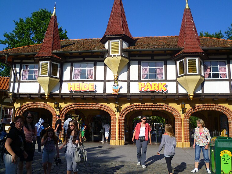
Photo: YanCoasterman, CC BY-SA 3.0.
Dittmern is a village in the borough of Soltau in the Heidekreis district in the German state of Lower Saxony. The village has 783 inhabitants. The hamlets of Friedrichseck, Hambostel, Grüne Aue, Heidenhof and Höpenhof belong to the parish of Dittmern. Dittmern is situated 3 km east of Drögenheide.
Drögenheide
- Type: Hamlet
- Category: locality
- Location: Lower Saxony, Germany, Central Europe, Europe
- View on OpenStreetMap
Latitude
53.01711° or 53° 1′ 2″ northLongitude
9.86364° or 9° 51′ 49″ eastOpen location code
9F5F2V87+RFOpenStreetMap ID
node 1071125949OpenStreetMap feature
place=hamlet
This page is based on OpenStreetMap, Wikidata, and Wikimedia Commons.
We’d love your help improving our open data sources. Thank you for contributing.
Satellite Map
Discover Drögenheide from above in high-definition satellite imagery.
Places with the Same Name
Discover other places named “Drögenheide”.
Localities in the Area
Explore places such as Friedrichseck and Wolterdingen (Siedlung Drögenheide).
Notable Places Nearby
Highlights include Kriegsgefangenenfriedhof Soltau - Ahlften and Heidenhof-Kapelle.
Lower Saxony: Must-Visit Destinations
Delve into Hanover, Göttingen, Brunswick, and Wolfsburg.
Curious Hamlets to Discover
Uncover intriguing hamlets from every corner of the globe.
About Mapcarta. Data © OpenStreetMap contributors and available under the Open Database License". Text is available under the CC BY-SA 4.0 license, except for photos, directions, and the map. Photo: Danapit, CC BY-SA 3.0.