Elbdeich 23
Elbdeich 23 is an office in Hamburg, Hamburg which is located on Neuhöfer Straße. Elbdeich 23 is situated nearby to the arts center Buntfarben, as well as near the health club Die Fitness Insel.| Tap on a place to explore it |
Places of Interest Nearby
Highlights include Hamburger Flaktürme and Wilhelmsburger Krankenhaus Groß-Sand.
Hamburger Flaktürme
Bunker
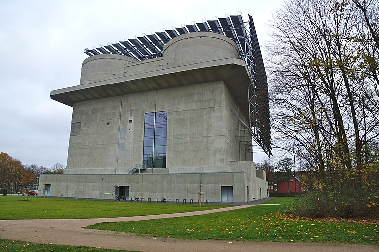
Photo: flamenc, CC BY-SA 3.0.
Hamburger Flaktürme is a bunker, which is situated 360 metres east of Elbdeich 23.
Wilhelmsburger Krankenhaus Groß-Sand
Hospital

Photo: Minderbinder, CC BY 4.0.
Wilhelmsburger Krankenhaus Groß-Sand is a hospital, which is situated 640 metres south of Elbdeich 23.
Sprach- und Bewegungszentrum
Public building
 Sprach- und Bewegungszentrum is a public building, which is situated 490 metres northeast of Elbdeich 23.
Places in the Area
Nearby places include Reiherstiegviertel and South Hamburg.
Reiherstiegviertel
Neighborhood

Photo: Pauli-Pirat, CC BY-SA 4.0.
Reiherstiegviertel is a neighborhood.
South Hamburg
The southern bank of the river Elbe in Hamburg is dominated by the city's massive port. You will find the Finkenwerder airport, the site of the Airbus aircraft assembly plant there, which is a planespotter's favourite, and further south the district of Harburg, which used to be a separate city and has a long history.Wilhelmsburg
Suburb

Photo: Wikimedia, CC BY-SA 3.0.
Wilhelmsburg is a quarter of Hamburg, Germany within the borough of Hamburg-Mitte. It is situated on several islands between the Northern and Southern branches of the Elbe river, together with the other quarters of Steinwerder, Veddel and Kleiner Grasbrook.
Elbdeich 23
- Type: Office
- Address: 18, Neuhöfer Straße 23
- Location: Hamburg, Hamburg, Freie und Hansestadt, Hamburg, Germany, Central Europe, Europe
- View on OpenStreetMap
Latitude
53.5094° or 53° 30′ 34″ northLongitude
9.98458° or 9° 59′ 5″ eastOpen location code
9F5FGX5M+QROpenStreetMap ID
node 10786841049OpenStreetMap feature
office=yes
This page is based on OpenStreetMap, Wikidata, and Wikimedia Commons.
We’d love your help improving our open data sources. Thank you for contributing.
Satellite Map
Discover Elbdeich 23 from above in high-definition satellite imagery.
Notable Places Nearby
Highlights include Buntfarben and Die Fitness Insel.
Nearby Places
Explore places such as Morawetz / Ehlers and WilhelmsRock - Probenraum.
Hamburg: Must-Visit Destinations
Delve into Altona-St. Pauli, Neustadt-Altstadt, East Hamburg, and North Hamburg.
Curious Offices to Discover
Uncover intriguing offices from every corner of the globe.
About Mapcarta. Data © OpenStreetMap contributors and available under the Open Database License". Text is available under the CC BY-SA 4.0 license, except for photos, directions, and the map. Photo: Joerg Moellenkamp, CC BY 2.0.